Milestones, Boundary Markers, Historical Artifacts, Street Furniture, lost roads and buildings.

There are many traces of our ancestors scattered around our landscape. Mile Markers and Boundary stones are there too. The Milestone Society believes that there are approximately 9000 left in the United Kingdom. Some are cherished but others are hidden in hedgerows, some have been unwittingly destroyed by crashes, road equipment or even stolen. Roads have been straightened to make them safer. There are old gateposts still left in place, old buildings, and place names that declare an evocative past. The aim is to capture some of this information at least photographically before it disappears.

Although the Fylde Coast does not have ancient history, the Romans apparently struggled to Kirkham. There have been huge changes in the last two centuries from literally a a few fishermans' and agricultural dwellings, to a full blown tourist and light engineering industry.

More historical information can be found here about the Fylde coast.

It also seems that time has marched on and left what appears to be some very respectable buildings... which just should be used, but seem to have no worth.

Links from this Blog

Nearly-Midnight The genealogy website relating to the family. A tangled web of people all related to one another, explore!
Memorials Website dedicated to War Memorials - The majority in the North of England. Visits to churches, but also memorials in out of the way places.
Robert Clark The Father of Henry Martyn-Clark - A missionary out in the North-West Frontier of India. One of the first Europeans to set foot in Afganistan
Affetside Census
A small village north of Bury, Lancashire, I can trace many of my immediate ancesters from there. On the Roman Road, Watling Street
Andrew Martyn-Clark My Father and his part in my World. Also my mother and his parents too.
Henry Martyn-Clark My Great Grandfather, his roots and his achievements. Discusses malaria but also his confrontations with Islam.

Friday, 14 October 2011

Milestones in Penzance

No doubt I have missed a few, but we only spent one day in this fascinating Cornish town. I will build a Datastore page with all the "general" photographs there. Walked to Gulval and found interesting artifacts and milestones both there and on the way back.

Walk up the promenade until you reach the bridge over the railway line. When you cross the bridge and meet the main road near a garage you will find this milestone. This milestone shows Hayle 7 miles, Cambourne 13 miles, Redruth and Truro. This milepost has clearly, like many, has had a knock

This is the reverse side. 1 mile to Penzance and Lands End is 11 miles!
Not a lot after that!

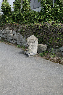
This milestone is a little mysterious. It is almost facing Hannah Bennetts Water Fountain.
This means that it is clearly inside Penzance proper. Not sure what the 16 is, if in fact it is 16. Suspect it may be some sort of boundary post. It is in quite an exposed position across the road from the fountain.


Thursday, 13 October 2011

Nabbs House Folly

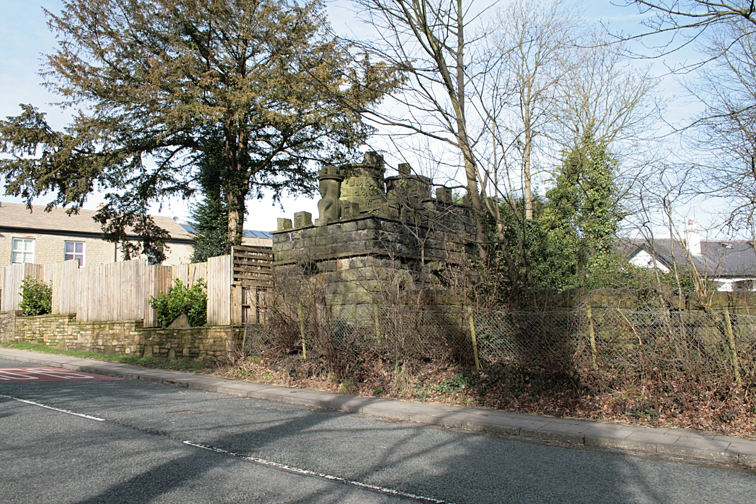
Nabbs House Folly is situated on Brandlesome Road about half a mile from the Bulls Head pub in Greenmount proper, heading towards Bury on the left-hand side is a most peculiar building. This is Nabbs House Folly. When I visited it was in a considerable state of disrepair. It is situated at the Bury end of a triangular garden. It seems to have been called "The Images", but I never heard it called that in the 20 years I was in Tottington.

The interesting for me is a similarity in the stonework with Tottington Dungeon. They were built at approximately the same time 1830's out of local stone Link to the Dungeon here

However here is the extract from the proposal in I believe about 2008 for a restore of this folly.

The full document can be found here:
http://www.scribd.com/doc/68670859/00040800-1

My photos are taken in 2011 It seems that the folly may have fallen further into disrepair.


“The Folly known as ”The Images” was build probably c. 1835 by John
Turner. Sited at the apex of the triangular garden, terminating the short
vista from the house and backing on Brandlesholme Road and the
converging minor, Nabbs Way.
Gothic in style, having the character of miniature castle on the rear, road
sides and that of bare ruined choir on the front facing the house. Front
symmetrically arcaded with narrow Gothic arches. Twin circular turrets
behind. Rusticated walls of one storey height to three sides of rectangular
rear”. (Extract from SD 71 SE 5/5.)

Ralph Rooney

“This castle-like summerhouse has numerous gargoyles on the rim of the battlemented walls and protruding from the walls. These are said to represent the faces of Greenmount villagers to whom John turner had taken particular dislike. The heads of the gargoyles are hollow, and
in wet weather water dribbled from their ears and mouths. The inside of the summerhouse was once panelled with richly carved oak. It was said that Turner, an eccentric man and his valet would occasionally go on the binge, spending days at the time locked in the summerhouse. There were various passages leading back to the main house. The passages one lined with coloured glass, opened out into rooms in which there were more stone carvings of animals and people. A most impressive one is of a man lying on a couch, gun at his side and dog at his feet. John turner devised some tricky water spouts along the approach to the house. One was a brass hose cunningly concealed in the cobbles at his front gate, one
over the front door and another in summerhouse. He used these on any undesirable visitors, who were given an unexpected soaking...”

Extract from “ The Story of my Life” by Ralph Rooney.

I believe this has gone back into print...

The rear of the folly. This picture is taken from the rear of the folly.
Nabbs House is just beyond.
Also the rear, Close up of Animal head

A grinning skull

Photographed from Brandlesome Road. Looks very like a chess piece. Note the 2 skulls at either side

Further away, Nabbs House in the background to the left. The bungalows on Nabbs Close are to the right.
I do believe there was a carving of an upper body holding a stone. Allegedly if you went past on the hour the stone would be thrown at you. We alway ran past - Don't take any chances.

Some other gleanings from the Internet.

John Turner on the 1841 Census clearly showing Nabbs House

John Turner in the 1861 census at the age of 50 with a servant

John Heap; this extract was from an armoury magazine

Mentions Edward Turner, perhaps a son, but he was certainly into hunting with dogs.

Tied up with Railways. The extract did not say what clearly a man of substance

More interesting, because I actually knew this woman. My mother was a flower arranger and Edna Wood ran a business from Nabbs house, renting and perhaps selling plastic flower arrangements. She was certainly very forceful. It did seem like a good idea. I recall my father getting roped in once. They designed a "kit" that you could assemble yourself. She exhibited at a major trade fair in Blackpool and did quite well as I recall. Was in Nabbs House quite a few times in my early teens.

Seems like an opportunity for more research - but the photos are on the web. The PDF file with more pictures is there also. I think I want to return and blag my way in and update the file.

Monday, 10 October 2011

Tottington Dungeon

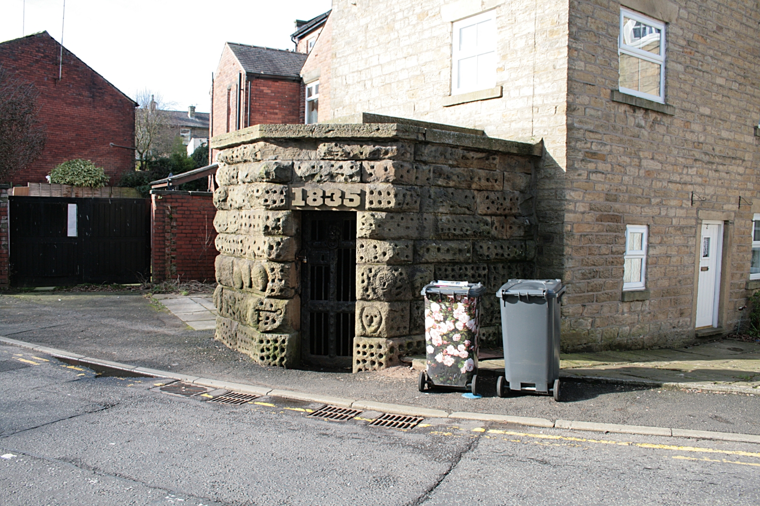
This is easily one of the most curious artifacts in the Bury area. It does not appear to have any history. It was certainly in existence in my Grandmother's day who used it as a threat if we were naughty. But it just seems to have always been there. It has been called the Tottington "lock up" which is probably more correct. Dungeon's to my way of thinking should be bigger and blacker and considerably more villainous.

The BBC Domesday website says " It was a small triangular shape with a steel door and not a lot of room inside. It would hold about 6 people, and inside there were those arm and leg shackles with a stone bench to sit or sleep on.

It was not a real dungeon, it was used for all the drunks and the ones who cause trouble. The constable was not a real policeman but a voluntary job. The constable is reputed to have left the doors open and let the prisoners escape to save him the job of taking them to court.

In 1964 Salford Folk Museum wanted to take it stone by stone off Tottington's hands, but the locals wanted to preserve it as a link with the past, and to keep it as a monument."

Closer up. Some of the faces can be seen! Practically every stone is marked in some way. There is a geometric pattern to some of the stones. Difficult to see why the "1885" is quite carefully cut out and the remainder of the stones are quite roughly hewn. There is a face on the right that seems quite representative. But the holes are very rough and unguided in there exact position
Peel Tower to celebrate Robert Peel's life was only erected in 1852 - so it dates from that era. The position of the dungeon is in quite a curious place. It would seem logical to place it in Tottington town centre. It has been placed at the position of the only place the road divides.

The pub behind or in front of the Dungeon was  built considerably later, but I think the Dungeon must have been built at the same time as the cottages it is joined to.

Apparently a museum in Salford wanted to hijack the Dungeon in the 1980's.

However the pictures:

I do not recall any hauntings, strange happenings or any strange rumours surrounding this building. But it is well worth a visit!


Taken from Harwood Road. The building on the left is the back of the "Old Dungeon" pub


View through the door. The stne on the right is the "original" stone. The stone on the left-hand side is smoother for some reason. Could the stones on the right belong to the cottages.

The irongate

From Harwood Road. The way the top is attached is curious. There is another slab on top of the several that make the flat top.

Old Dungeon Inn. On the left are the houses that are against the Dungeon

The exit of Harwood road. Standing with my back to the Dungeon. The main road curles away to right and heads through Tottington proper and thence to Bury. The white faced building was the Printers Arms - now I think it is an Italian restaurant. This road curls around and heads towards Greenmount past Brookhouse. Very much a secondary road at the time. It was cobbles in my youth. The road heading out of the left of the picture is Turton Road. - eventually heads to Bolton.

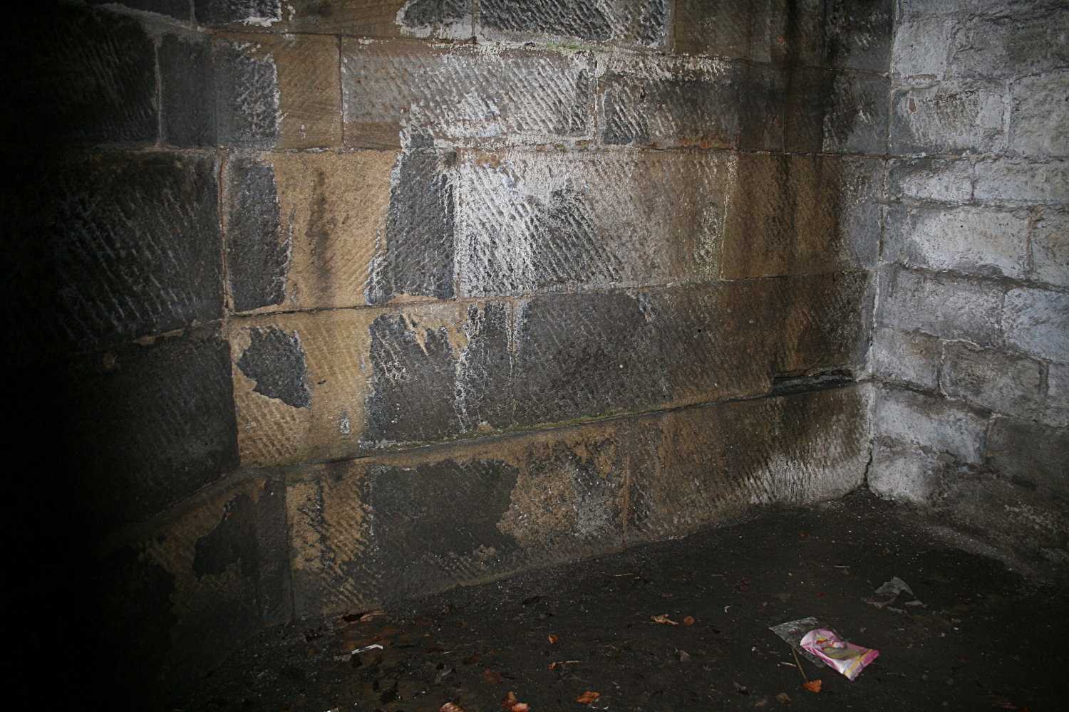
Another view of the inside. Quite well dressed stone. The walls could be two layers thick. The wall on the right may well be the back wall of the cottage. If that is the case It would seem that the Dungeon was built after the cottages were.

Close up of the Door. Seems cast. The dogs head seems to be part of the casting. The knocker doesn't work. Some renovation work has taken place The bolts on the top are not all original. The clasp is most definitely new.

Birds eye view from Harwood Road - Pub on left.
However there is another building within a mile that also warrants investigation because they are quite similar. This is Nabbs House Folly, there are strong similarities in the way the stones are treated. Speculation.

Monday, 3 October 2011

St. Annes War Memorial Hospital

Situated at the far end of St Annes road East lies the "remains" of the hospital. Surrounded by trees it displays what a treasure the stonework must have been. Truly a jewel in the crown of St Annes. Victorian opulence gone bonkers. Beautiful stone work.  Morris homes eat your heart out!


The inscription reads:

ST ANNES WAR MEMORIAL HOSPITAL
1922 - 1991

Opened by Lord Derby in May 1922
this former Bannister family home
was gifted to the community by
Lord Ashton, to honour local war dead

Supported entirely by
public subscription until 1948,
it closed in 1991, and was
demolished in 1996


The main entrance. I can't help but think some of the
brickwork has been renovated and rebuilt


Sandstone scroll

Fylde Borough Council
1998
CIVIC CONSERVATION AWARDS
PREMIER AWARD
FOR
Conservation Areas and Listed Buildings


One of the new houses behind

View from the opposite side of the road
I run past here about 3 times a week. The entrance is set slightly back. I wonder what happened to the residents. It is certainly strangely quiet even though there are houses in the grounds.

Thursday, 11 August 2011

Penzance Water Fountain

Hannah Bennett's Drinking Fountain

This is situated on the Chynadour Cliff road about one mile from the town centre. The road is quite busy. The water fountain is in quite a poor state of repair. The right hand column is missing - as is the actual tap or dispenser on the top section. There is a large crack on the left and the main bowl has a large chip out of it. The front is a a marble face about an inch thick. This is neither clean or in a good state.


The Water fountain is between the two cars. The wall has been set back and the fountain is in its own bay. This photograph has been taken from a milestone set in the wall on the righthand side of the road. This looks over the harbour to the town of Penzance proper. Behind the fountain the wall drops 50 feet to the railway below.


With St Michael's Mount in the background

 The inscription reads

I MEMORY 
OF
HANNAH BENNETT
ERECTED BY
HER CHILDREN
1886

The Lower inscription reads:

"HE PRAYEST BEST WHO LOVETH BEST,
ALL THINGS GOTH GREAT AND SMALL
FOR THE DEAR GOD, WHO LOVETH US,
HE MADE AND LOVETH ALL"

Quite an odd inscription


View from the left. This is the end of the line!

If you look at the bottom of the fountain, just above the bottom bowl is the name of the stone mason who made the fountain.


 A search of Angwin Stonemason reveals quite a few entries, but the excerpt below from Joan Taber seems to be the most comprehensive. Angwin does seem to be a Cornish name.


 This is a list of entries from http://freepages.genealogy.rootsweb.ancestry.com/~stonemen/. This has a phenomenal amount of information, much of which is of concern to me. The list is compiled by Joan Taber - I will be contacting her for permission to use the extract on her site. It is difficult work out which Angwin may have built the water fountain. Possibly more than one.

"ANGWIN, Richard, b.1837 St.Buryan-Con, Sculptor, Stone & Marble Mason, address 1864: 53 Causewayhead, Penzance-Con, 1871: Falmouth-Con, 1881: 57 Causeway Head, Penzance-Con, 1883: 62 Causeway Head, Penzance-Con, 1891: 57 Causeway Head, Penzance-Con, 1893: 62 Causeway Head, Penzance-Con, 1910: 62 Causeway Head, Penzance-Con.

ANGWIN, Richard, b.1822 St.Just inPenwith-Con, Mason, address 1861: North Row, St.Just inPenwith-Con.

ANGWIN, Richard, b.1856 St.Buryan-Con, Stone Mason, address 1871: St.Buryan-Con, 1881: Church Town, St.Buryan-Con.

ANGWIN, Richard Joseph, b.1871 Falmouth-Con, Apprentice Marble Mason, address 1881: 57 Causeway Head, Penzance-Con, 1891: 57 Causeway Head, Penzance-Con.

ANGWIN, William, b.1851 St.Buryan-Con, Granite Quarrier, address 1881: Church Town, St.Buryan-Con. ANGWIN, William, b.1851-1853 Paul-Con, Mason, address 1887: Trewithel, Paul-Con, 1891: Jamaica Place, Madron-Con."

Hopefully this is listed - It needs to be if it is going to survive - clearly this water fountain may not survive much longer without remedial care.Opposite to the water fountain is a Milestone or Boundary stone. This is shown at this link.

Tuesday, 19 July 2011

Calderdale and Bacup boundary stones

On the Rossendale Way in this part, there are 2 boundary stones. As you head towards Hades hill going south  from Sharneyford, it is possible to see the taller of the two, Calderdale boundary stone, from quite a fair distance.
Calderdale Boundary stone in the middle of the picture
To the right of the boundary stone which is marked S & T you meet a broken down 4 barred gate which you cross. This is on the way to Hades Hill. On your right is the Bacup boundary stone.


The Calderdale Boundary Stone, The Barbed wire fence is to your left.


The Calderdale Boundary Stone, Hades Hill in the distance
This Boundary stone is literally yards away from the Calderdale stone.  The Rossendale way keeps to the left of the boundary wall.

The Bacup Boundary Stone, Not sure what the 42 means!

The weather was absolutely clear today. On previous trips over the top it has been absolutely dire. The rest of the route goes over Middle Hill and Brown Wardle hill, heading south. It is quite a long stage.
This is my link to the Rossy way adventure!!!


Friday, 15 July 2011

Fleetwood Drinking Fountain, Cannon and Railway Hotel

There is a Drinking Fountain in Fleetwood. It is dedicated to James Abram and George Greenall. There is also an Obelisk dedicated to their memory too here.
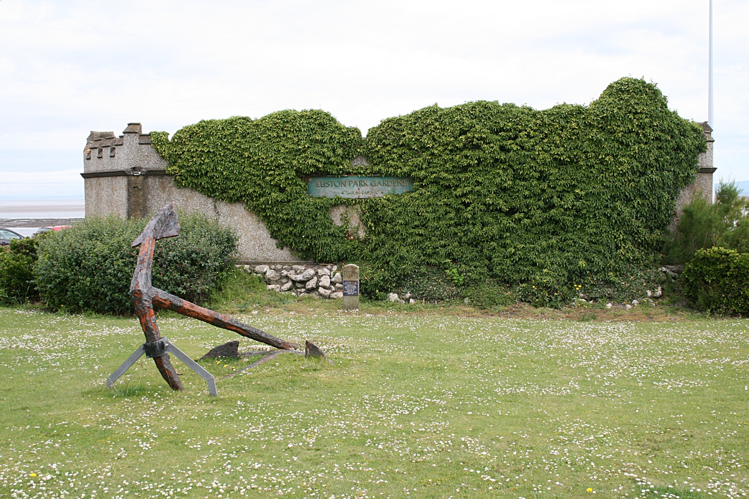
It is just outside the Euston Gardens by the North Euston Hotel. Just inside the Gardens is a cannon. I don't know anything about the Cannon but here is a picture! The North Euston Hotel is also included in these pictures. The gardens are called the Euston Park Gardens.

Fleetwood Cannon

Drinking Fountain which relates to the obelisk close by

An anchor, in front of the PWR boundary stone

THE PRESTON AND WYRE
RAILWAY BOUNDARY STONE
COMMEMORATING
THE FIRST TRAIN FROM
PRESTON TO FLEETWOOD
ON 15TH JULY 1840
RECOVERED BY
FLEETWOOD CIVIC SOCIETY
MARCH 1987


Stone Carving of the
Crest of the Lancashire and Yorkshire Railway

THIS STONE SHOWS THE LAND AND SEA
OPERATIONS OF THE L & Y RAILWAY CO.
AT FLEETWOOD - CIRCA 1875
PRESENTED TO THE TOWN BY THE
FLEETWOOD CIVIC SOCIETY - 1976


All these objects are in the gardens.

Thursday, 14 July 2011

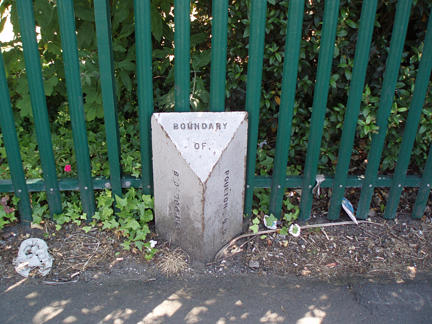
Garstang Road West Boundary marker

Looking towards Boundary Park from Blackpool Old Road

Looking daown Garstang Road West towards Poulton

The Blackpool side of the border!

The Poulton side of the border

Close Up!
Set of Photos of the boundary marker between Blackpool and Poulton at the junction of Garstang road west, Poulton Road and Blackpool Old road. This is the A586. Behind the railings is Boundary Park, further on is Grange Park Estate. Blackpool Old road has 3 school next to each other Collegiate High School, High Furlong and Blackpool Sixth form college. The location of the Boundary marker is here. Poulton is now part of Wyre borough. The post is cast iron painted white and in good condition. I suspect it is still in the correct place. But as Garstang Road West is a "new" road it may well have been resited although in the correct location.