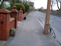
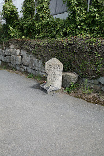
Milestones, Boundary Markers, Historical Artifacts, Street Furniture, lost roads and buildings.

There are many traces of our ancestors scattered around our landscape. Mile Markers and Boundary stones are there too. The Milestone Society believes that there are approximately 9000 left in the United Kingdom. Some are cherished but others are hidden in hedgerows, some have been unwittingly destroyed by crashes, road equipment or even stolen. Roads have been straightened to make them safer. There are old gateposts still left in place, old buildings, and place names that declare an evocative past. The aim is to capture some of this information at least photographically before it disappears.

Although the Fylde Coast does not have ancient history, the Romans apparently struggled to Kirkham. There have been huge changes in the last two centuries from literally a a few fishermans' and agricultural dwellings, to a full blown tourist and light engineering industry.

More historical information can be found here about the Fylde coast.

It also seems that time has marched on and left what appears to be some very respectable buildings... which just should be used, but seem to have no worth.

Links from this Blog

Nearly-Midnight The genealogy website relating to the family. A tangled web of people all related to one another, explore!
Memorials Website dedicated to War Memorials - The majority in the North of England. Visits to churches, but also memorials in out of the way places.
Robert Clark The Father of Henry Martyn-Clark - A missionary out in the North-West Frontier of India. One of the first Europeans to set foot in Afganistan
Affetside Census
A small village north of Bury, Lancashire, I can trace many of my immediate ancesters from there. On the Roman Road, Watling Street
Andrew Martyn-Clark My Father and his part in my World. Also my mother and his parents too.
Henry Martyn-Clark My Great Grandfather, his roots and his achievements. Discusses malaria but also his confrontations with Islam.

Showing posts with label Milestone. Show all posts

Friday, 15 March 2013

Milestone at Castlerigg, Keswick

I missed my turn off when descending from Walla Crag and found this milestone.
It has the reference CU_KWWM01 in the milestone database.
Here are the 3 shots!
Close-up looking towards Keswick

Looking up the Ambleside road

Close up looking up the road


Saturday, 8 December 2012

Milestone on the B5192

Pictures of a very substantial milestone. This is very large, made of concrete, and cemented to someone's wall. It is also halfway up the rise of the "back" road into Kirkham. About 250 yards from the Dowbridge on the right hand side, opposite Glebe Lane. This milestone is documented on the Milestone Society database.
Half a mile from the Dowbridge cross .

Here are the Pictures:
Preston
7 3/4  Miles

Kirkham

I think it says?
Kirkham
?/? Mile? (possibly 3/4 - that would be about right)
Blackpool
10 Miles


It is steep, but not quite as steep as the photo suggests.
Holding the wall up!

Not sure about this. On the opposite side of the road
and considerably smaller than any of the chunky stone milestones locally.


Friday, 14 October 2011

Milestones in Penzance

No doubt I have missed a few, but we only spent one day in this fascinating Cornish town. I will build a Datastore page with all the "general" photographs there. Walked to Gulval and found interesting artifacts and milestones both there and on the way back.

Walk up the promenade until you reach the bridge over the railway line. When you cross the bridge and meet the main road near a garage you will find this milestone. This milestone shows Hayle 7 miles, Cambourne 13 miles, Redruth and Truro. This milepost has clearly, like many, has had a knock

This is the reverse side. 1 mile to Penzance and Lands End is 11 miles!
Not a lot after that!

This milestone is a little mysterious. It is almost facing Hannah Bennetts Water Fountain.
This means that it is clearly inside Penzance proper. Not sure what the 16 is, if in fact it is 16. Suspect it may be some sort of boundary post. It is in quite an exposed position across the road from the fountain.


Thursday, 5 May 2011

Kirkby Lonsdale six miles away


This milestone is set 6 miles from Kirkby Lonsdale and 6 mile from Kendal. Like the others it is painted white and the letters are picked out in black. The Grid Reference is 572868. The reference from the milestone society is WE_KLKDa06  The location of the milestone can be found here

Kirkby Lonsdale seven miles away


 This milepost is situated seven miles from Kirkby Lonsdale. It has been kept in quite good condition. The stone is painted white and the lettering is picked out in black paint. The map reference is 566883. The stone is on the B6254 and is 100yards esat of Hutton Yeat. The reference for the milestone on the milestone database is WE_KLKDa07. The location of the milepost is here


Wednesday, 4 May 2011

Kirkby Lonsdale eight miles away


This mile post is set a few hundred yards west of Middleshaw on the B6254 Its map reference is 554892
The reference number for the milestone society is WE_KLKDa08. The milestone is situated northern side of the road. Originally painted white with black lettering, but the paint is peeling and although the stone is in good condition it appears a bit tatty.
The location of the milepost can be found here


Tuesday, 3 May 2011

Kirkby Lonsdale four miles away


Looking North
  
Looking South

This milepost is situated on the B6254. It seems this road was called the "Old Scotch Road" The milepost is situated 4 miles from Kirkby Lonsdale and 8 miles from Kendal. It has been painted white recently but the paint is flaking off. The letters were highlighted in black. When the grass is long - it will be practically invisible. The map reference is SD 586 842 and is listed WE_KLKDa04 on the Milestone register. The location is here.

Sunday, 1 May 2011

Upper Rawcliffe - St Michaels-on-Wyre


I visited a car-boot sale near St Michaels. I knew the church was really old and that it had a memorial. I did not really believe how much history the church has, but seeing this milepost on the way in was a real bonus. The milepost is situated about 600 yards from the roundabout just before the church and the bridge over the river Wyre. Painted white and the lettering is picked out in black paint. The upper inscription says "Upper Rawcliffe" The Lancaster side reads - Garstang 4.25 miles and Lancaster 15 miles - The Blackpool side reads - Great Eccleston 2.25 miles, Poulton-le-Fylde 8.25 - Blackpool 12 miles.

The OS reference is SD 45784 4096. The road is called Blackpool road - A586

This has been surveyed by the Milestone Society and has the reference LA_BPGS12

Friday, 29 April 2011

Kirkby Lonsdale 1 mile away


Just outside Kearstwick
Facing Kendal

This mile post says Kirby Lonsdale is a mile away!
Facing Kirby Lonsdale
The map reference is 605802 and the road is B6254. The milestone is positioned just before Kearstwick as you travel into Kirkby Lonsdale.
Its location is shown here

Sunday, 24 April 2011

Milestone on the Kirkby Lonsdale to Kendal Road (B6254). Kirkby Lonsdale 3 Miles away

Old and New!
Looking towards Old Hutton
Looking towards Kirby Lonsdale

Close up!
 This milestone is at a place called Old Town, 3 miles from Kirkby Lonsdale. As the milepost says  255 mile from London too!

The milepost is at the junction of the Killington (best known for its service station and also the lake) and the Kirkby-Kendal road. Amazing how someone has not flattened it yet. Love the mix between the old and new. The map reference is 595830. Situated on the B6254. The location can be found here.


The Lupton and Preston Patrick Boundary post

Situated on northern side of the Old Hutton to Kirkby Lonsdale road, the B6254,  is the Boundary post between Lupton and Preston Patrick. The map reference is 589 837.
Bleabeck Bridge
Both sides
Preston Patrick
Lupton
Captured this post unexpectedly as I was photographing the milestones on this same road. - more to come. The stone is in a slight depression called  Bleabeck Bridge. I suspect it is almost invisible in summer when the grass gets longer.


Wednesday, 13 April 2011

Skew Bridge milestone

Heading to Lytham
Heading to Blackpool 4 miles
 These 3 shots are of the milestone on the road that travels from Lytham to Blackpool. The Smithy Lane milepost is a mile closer to Blackpool. There don't appear to be any remaining mileposts on this stretch of road between Blackpool and Lytham. There has been much modification and widening so I suppose its surprising that these these to have survived. The road in the top picture heads to Lytham, just to the left is the railway bridge called Skew Bridge, maybe its because it goes at a skew! However the road will have gone straight and I suspect it ran along the edge of the Clifton estate.
Milestone with Markings
The final close up shows some markings which are rather more unusual. Difficult to say their age but the weathering and the growth suggest quite a long time ago. There also appears to be the remains of a pin which seems to have held a small plate perhaps.

This road is considered to be the "back" road between Lytham and Blackpool. It can get very congested at rush hour.St Cuthberts Cross is also on the same road about a mile further south.


Wednesday, 30 March 2011

Smithy Lane Milepost


Smith Lane Milepost
Smithy Lane Milepost
Just north of the junction of Smithy Lane and North Houses lane is a milepost. This lies on the left-hand side of Heyhouses lane on the route to Blackpool. The only discernible writing is a 3 on the side that shows the way to Blackpool. It would certainly seem to be 3 mile from there whether you took the "longer" route around Queensway or the route which probably went across the airport. It seems cared for and in no danger of being removed. This is the location of the milepost. The next milepost towards Blackpool will be almost outside the Queensway pub(Now  a Harvester). Blackpool Road North then heads towards Blackpool and joins Leach Lane, and heads across the Airport. Old maps show a milestone on the airport. Whether it still exists is unlikely. Leach lane then crosses Squire Gate lane at the Halfway House Pub. There is a boundary marker there. 
Heyhouses Lane