Milestones, Boundary Markers, Historical Artifacts, Street Furniture, lost roads and buildings.

There are many traces of our ancestors scattered around our landscape. Mile Markers and Boundary stones are there too. The Milestone Society believes that there are approximately 9000 left in the United Kingdom. Some are cherished but others are hidden in hedgerows, some have been unwittingly destroyed by crashes, road equipment or even stolen. Roads have been straightened to make them safer. There are old gateposts still left in place, old buildings, and place names that declare an evocative past. The aim is to capture some of this information at least photographically before it disappears.

Although the Fylde Coast does not have ancient history, the Romans apparently struggled to Kirkham. There have been huge changes in the last two centuries from literally a a few fishermans' and agricultural dwellings, to a full blown tourist and light engineering industry.

More historical information can be found here about the Fylde coast.
It also seems that time has marched on and left what appears to be some very respectable buildings... which just should be used, but seem to have no worth.

Links from this Blog

Nearly-Midnight The genealogy website relating to the family. A tangled web of people all related to one another, explore!
Memorials Website dedicated to War Memorials - The majority in the North of England. Visits to churches, but also memorials in out of the way places.
Robert Clark The Father of Henry Martyn-Clark - A missionary out in the North-West Frontier of India. One of the first Europeans to set foot in Afganistan
Affetside Census
A small village north of Bury, Lancashire, I can trace many of my immediate ancesters from there. On the Roman Road, Watling Street
Andrew Martyn-Clark My Father and his part in my World. Also my mother and his parents too.
Henry Martyn-Clark My Great Grandfather, his roots and his achievements. Discusses malaria but also his confrontations with Islam.

Showing posts with label St Annes. Show all posts

Sunday, 17 June 2012

Queensway building land


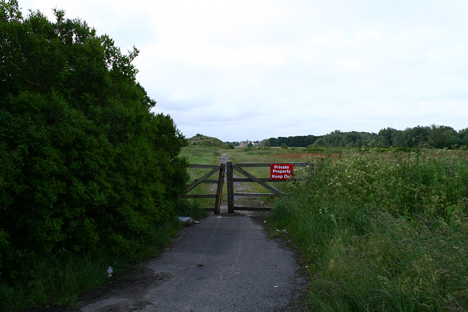
This is the road that comes straight off the Queensway junction. This lane (before here) hooks to the left and goes to Easterleigh. This lane used to go to a disused barn next to a disused bungalow where a murder took place. (Another link)The house was bulldozed and the pile of rocks and dirt is effectively the remains of a murder scene. This is the place I took the panorama. I  think the land may be owned by a local builder (Kensington). The houses in the distance are the edge of Cypress point.
Looking back towards Queensway The road lights are the lights that are on Queensway.
This was taken  at the bottom of the mound.

This is a 360 from besides the bush at the top of the mound in the previous photo. Easterliegh Animal sanctuary is on the left side of the bush. The junction at Kilnhouse lane is on the very far right of the panoramic. This looks good on a three screen rig.
Felt I needed to photograph the land at the junction of Kilnhouse lane and Queensway in St Annes. There have been numerous applications for building. The wildlife is endangered. Traffic will be appalling, services will be strangled. Another bit of the landscape gone for ever. Cypress Point has awfull water table issues. Pumps are running 24/7 just to stop the houses flooding. There is a considerable amount of instability here. The actual land is only a couple of feet above the highwater mark. However it gave me a chance to get up early with the tripod and try using the shots to build a panoramic of this land that will now be turned over to housing.

The second panorama of the day is taken from the inner side of Queensway. There is a triangle of heavily overgrown land next to the industrial estate which has got planning permission.

The path that extend through the picture goes across the fields and joins Queensway at the far end. The airport is facing us. The industrial estate is right in the centre. The path to the left is the reverse of the path that heads towards the tree and heads towards Queensway. If you carry on you cross Queensway and meet the road immediately above.

The panoramas were rendered in Hugin on a Linx Mint rig.

This is an extract from the Blackpool Evening Gazette on Friday 22nd of June 2012

A CONTROVERSIAL new housing development on the outskirts of St Annes has been given the go-ahead.

Kensington Developments has fought for years to win planning permission to build 1,150 homes on land off Queensway - and today a Government planning inspector and the secretary of state have finally given them the green-light.
The plans have been the subject of two planning inquiries after Fylde Council rejected the proposal - and dozens of local residents came out in fierce opposition to the scheme.
Plans for the M55 link road, which will connect Lytham and St Annes with the motorway, are closely tied to the development and today’s decision means that project will also go ahead.


Mixed views over major homes plan  

Published on Wednesday 12 December 2007 15:11

RESIDENTS have had their first look at plans for a multi-million pound housing estate set to transform rural land near St Annes.
The scheme, revealed in Tuesday's Gazette, would see Kensington Developments transform land off Queensway by building 1,150 homes over a 10-year period.
The proposed site, on the border of St Annes and Blackpool, will see environmentally friendly homes built at a rate of 175 a year, a primary school, an 86-acre park and a 50-acre deer park. The development will include 259 affordable homes.
Kensington will spend 20m completing the long-awaited M55 Heyhouses link road, constructing a Heyhouses Lane bypass and building a new roundabout at the junction of Queensway and Kilnhouse Lane.
Robin Howe, 61, who lives on Heyhouses Lane, believes the scheme is a "golden chance".
He said: "I think it is a fantastic opportunity for us to move forward.
"One of the massive benefits will be to turn Heyhouses Lane back into a road instead of a motorway."
Mr Howe's wife Debbie, 46, believes more properties are desperately needed.
She said: "People are screaming out for them because they have nowhere to live.
"Something like this will take the town on because it is stagnating now."
However, other residents fear the development will add to already hectic traffic in the Fylde town.
Palmira Stafford, 46, who lives in St Annes Road East, said: "I am concerned there is so much housing in such a small space.
"I have worries about the access roads coming into the borough. Our road is really busy at certain times anyway."
Derek Unsworth, 74, of Eldon Court, doesn't believe a major housing development should be built so close to Blackpool Airport.
He said: "I am dead against it. They will be sending jumbo jets down there soon and I believe it would be a big mistake to build anything other than industrial units there."
Peter Liversidge, deputy managing director of Kensington, was on hand to talk to people about the plans.
He said: "We are very pleased with the public's reaction and interest in the scheme.
"Most people say the link road is a much-needed facility in the area. A residential development is the only way to do that.
"People have been particularly worried about the impact on wildlife but we will have a park alongside a wetland habitat."

A 50 Acre Deer Park - What!!

Make your own minds up.


Thursday, 10 November 2011

St Annes-on-Sea Water Fountains

Back to the pretty stuff! There are two water Fountains on St Annes seafront, Both are pretty old - I will do research later. There is a small one at the entrance to the, now open swimming pool, which is the most southern one. Further up the promenade and close to the Mexico monument is a far larger and still working fountain. It is very large, quite magnificent and constantly being repainted by the council. No sophisticated colours here! For the first time I have added a video to an item on any of my blogs. It is here

Early Sunday morning before the car-park gets busy.
This is set back about 5 yards from the footpath next to the main prom road.
The reopened swimming pool is in the background.
The boating pool is to the right of this and the new lifeboat house is there too.

Closer still! About 7 feet in all. About half the size of the next one. This is right on the thoroughfare. Have to walk round it to get to the swimming pool.

It does have the exterior equipment to work - but I have seen it working!

4 sides, each one has an aquatic theme.
Beautifully rendered casting. Can only be done in iron

A pipe on the other side too. This is facing the road.

Facing South.

Close up of the base. The design is so similar to the other fountain.

Not quite a circular surround but definitely rounded bays

This is the drinking trough for dogs. This is probably rain water

View from the base
 The images below are the larger water fountain. It is about 400 yards north of the first one. The "Mexico" monument is nearby as is the bandstand.
From the promenade - the main prom route is just in front of the hotels

Looking North - but still prom side

Roadside but looking North

Looking due South - the new cafe is just by the edge of the prom
and juts out over the boating pool

Detail of the caste base. This is cast iron and it's high quality

Closer still It is possible to see the join between castings.
Every casting is identical in the base

Still working - Obviously an aquatic theme to the whole fountain.

The water is about 10 to 12 inches deep
One or two of the shells are broken.
Overall there is very little damage to the whole fountain

One of the damaged shells to the right


Pretty impressive casting
Supporting the cherub at the top

Pan/Cherub in all about 15 feet high!
Embedded the other video here!


Saturday, 22 October 2011

Lighteach

Another sad sight! Maybe this grand old house will be demolished by November. Looks pretty desolate. Bricks are sound - but its too late... Going to be demolished and Granny flats put up in its place or so I presume. ....Aaaagh...

From the main coast road


Lighteach

From the Moorings

From "The Moorings" drive
This house situated by "The Moorings" rest home on the promenade route to Blackpool. Just to the north of St Annes pier. There are some very fine houses here. I rented a flat in one in the late '60's. Sand got everywhere and it was really draughty. Sealed all the windows up with parcel tape. Good days! I may update the site when it has gone.


The final picture!

Only the gateposts left!

Monday, 3 October 2011

St. Annes War Memorial Hospital

Situated at the far end of St Annes road East lies the "remains" of the hospital. Surrounded by trees it displays what a treasure the stonework must have been. Truly a jewel in the crown of St Annes. Victorian opulence gone bonkers. Beautiful stone work.  Morris homes eat your heart out!


The inscription reads:

ST ANNES WAR MEMORIAL HOSPITAL
1922 - 1991

Opened by Lord Derby in May 1922
this former Bannister family home
was gifted to the community by
Lord Ashton, to honour local war dead

Supported entirely by
public subscription until 1948,
it closed in 1991, and was
demolished in 1996


The main entrance. I can't help but think some of the
brickwork has been renovated and rebuilt


Sandstone scroll

Fylde Borough Council
1998
CIVIC CONSERVATION AWARDS
PREMIER AWARD
FOR
Conservation Areas and Listed Buildings


One of the new houses behind

View from the opposite side of the road
I run past here about 3 times a week. The entrance is set slightly back. I wonder what happened to the residents. It is certainly strangely quiet even though there are houses in the grounds.

Wednesday, 30 March 2011

Smithy Lane Milepost


Smith Lane Milepost
Smithy Lane Milepost
Just north of the junction of Smithy Lane and North Houses lane is a milepost. This lies on the left-hand side of Heyhouses lane on the route to Blackpool. The only discernible writing is a 3 on the side that shows the way to Blackpool. It would certainly seem to be 3 mile from there whether you took the "longer" route around Queensway or the route which probably went across the airport. It seems cared for and in no danger of being removed. This is the location of the milepost. The next milepost towards Blackpool will be almost outside the Queensway pub(Now  a Harvester). Blackpool Road North then heads towards Blackpool and joins Leach Lane, and heads across the Airport. Old maps show a milestone on the airport. Whether it still exists is unlikely. Leach lane then crosses Squire Gate lane at the Halfway House Pub. There is a boundary marker there. 
Heyhouses Lane