There a quite a few WW2 artefacts relating to defence in Blackpool and the Fylde. Perhaps this is the least well known and least obvious. I have however managed to put this in a little more context than straight forward shots. The panorama and the shots with the cloudy skies were taken from the site of the now flattened abattoir. perhaps it's easy to see why no one would want to move into a house here. Don't mind doing any graveyard shots, but to be honest this is quite upsetting. Info underneath each photo:
Back to the bunker! This site has some more information and a little bit of history too as well as different photographs.
The final section is showing the demolished area around the old abattoir - make your own mind up about this. Been like this for a few years now.
 |
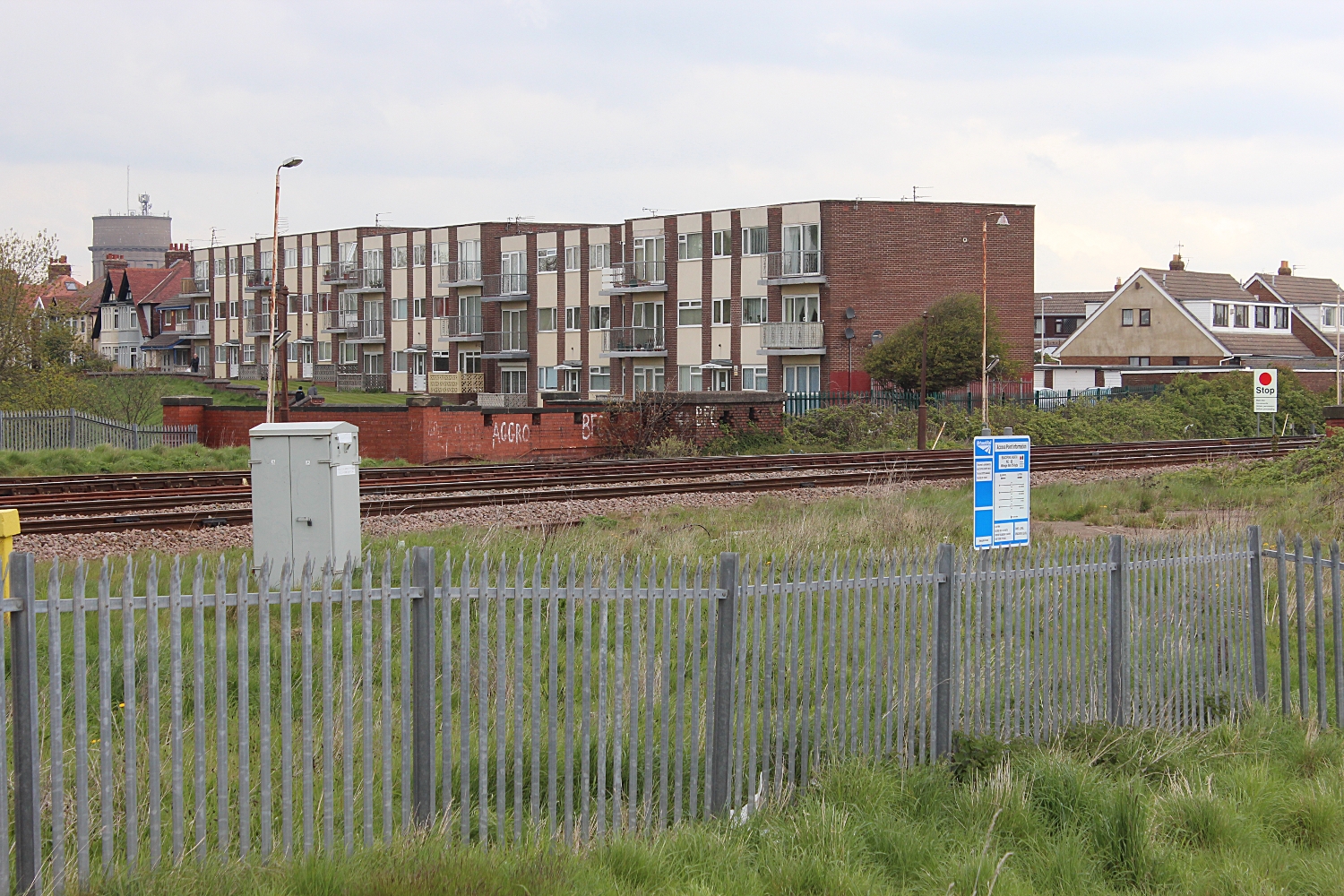
| This is from the highest point of the rubble from the demolished abattoir. The railway line runs from Blackpool North station on the left to Layton, Preston and beyond. On the right just below the flats is the bunker which sits above the loopholed bridge. This faces north. Devonshire road is just in front of the flats too |
 |
| This is the opposite view. The flats at Layton is the most obvious feature - due for demolition. I have many pictures of these from all over Blackpool. On the left is Burton's Biscuits. On the right is a new(ish) housing estate. Construction has stopped, perhaps someone will add a comment. Anyway the houses behind them are built on the remains of Billy Smith's Scrapyard and the Blackpool brewery. The houses to the right have started to be dismantled by the local hoodlums too. The road which runs from left to right is Devonshire road. Apologies for the strangely disjointed blue people carrier! I have got scarily big picture of both these panoramas. |
Back to the bunker! This site has some more information and a little bit of history too as well as different photographs.
 |
| Looking North up Devonshire Road. This is the top of the bridge. The loop holes can be seen on the left. The bunker is to the right. |
 |
| Almost identical shot |
 |
| This is too, but maybe a little clearer |
 |
| This picture is practically looking straight at previous one. I am just past the end wall of the flats above. This is the bridge looking south. |
 |
| A little further on. Leaning over the fencing. This is the roof of the bunker. The road is below me |
 |
| The same shot |
 |
| Don't ask. Clearly not a telephoto! Looking North. Devonshire road is beneath the bridge. Layton Flats in the distance! |
 |
| Added a bit of action - A train going to North Station! |
 | |
| Close up of built houses, tiles off and boarded up. The house to left are on Devonshire road and the ones to the right are new lived in ones. |
 |
| Further away, Layton flats about to be demolished. |
No comments:
Post a Comment