 |
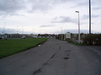
| Common Edge Road looking North |
 |
| Common Edge Road looking South |
 |
| Common Edge Road Boundary Marker This is the boundary marker that is set into the ground at the side of the old Common Edge road. The road was straightened and then it contined south to Queensway. Queensway is a circular route, curved to allow bigger planes to land at Blackpool Airport. This route is now considered to be the main inland route between Blackpool and Lytham St Annes. Some more house building is proposed in St Annes. This road can be extremely busy. A crash on the seafront road or this road can completely snarl traffic up. However this marker is one of the few that actually seems to be in the right place. The inscription reads: "FORMER BOUNDARY MARKER RE-ERECTED NEAR ITS OLD SITE TO RECORD EUROPEAN ARCHITECTURAL YEAR1975 BLACKPOOL CENTENARY YEAR 1976 AND THE FOUNDATION OF BLACKPOOL CIVIC TRUST" I do recall an old traction engine being parked close by this stone for many years. 100 yards north of the marker is Trebaron Garden Centre which is extremely popular. The Old Common Edge road is used as a feeder road to the Garden Centre but also the old row of cottages nearby. The Boundary Marker is on the extreme left of the photo, just out of shot. Just south is Division Lane and cuts across Common Edge road. The eastern end disappears onto the airport. This has long been considered the "proper" boundary between Blackpool and Lytham St Annes. Opposite, and on the other side of the road is a Pill Box dating back to the Second World War, now used to advertise rugby and cricket matches. The remains of the old Common Edge road cuts round the back of the Airport. On maps it is called Moss Edge Lane. Chance to explore. The links are photos on my Panoramio site. |
No comments:
Post a Comment