Milestones, Boundary Markers, Historical Artifacts, Street Furniture, lost roads and buildings.

There are many traces of our ancestors scattered around our landscape. Mile Markers and Boundary stones are there too. The Milestone Society believes that there are approximately 9000 left in the United Kingdom. Some are cherished but others are hidden in hedgerows, some have been unwittingly destroyed by crashes, road equipment or even stolen. Roads have been straightened to make them safer. There are old gateposts still left in place, old buildings, and place names that declare an evocative past. The aim is to capture some of this information at least photographically before it disappears.

Although the Fylde Coast does not have ancient history, the Romans apparently struggled to Kirkham. There have been huge changes in the last two centuries from literally a a few fishermans' and agricultural dwellings, to a full blown tourist and light engineering industry.

More historical information can be found here about the Fylde coast.
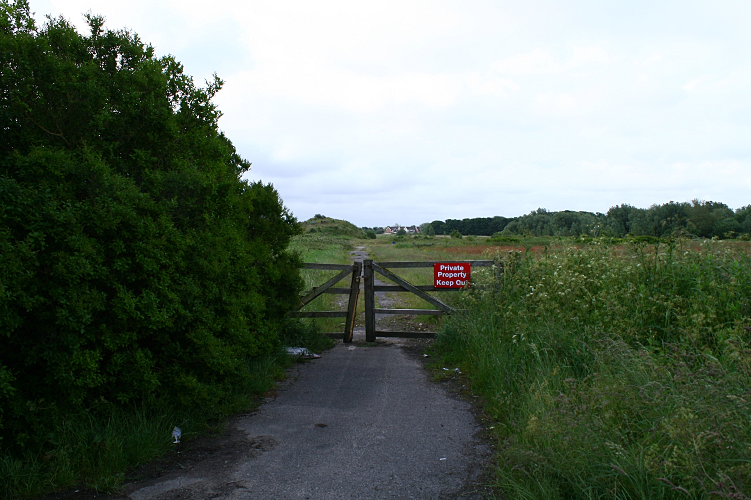
It also seems that time has marched on and left what appears to be some very respectable buildings... which just should be used, but seem to have no worth.

Links from this Blog

Nearly-Midnight The genealogy website relating to the family. A tangled web of people all related to one another, explore!
Memorials Website dedicated to War Memorials - The majority in the North of England. Visits to churches, but also memorials in out of the way places.
Robert Clark The Father of Henry Martyn-Clark - A missionary out in the North-West Frontier of India. One of the first Europeans to set foot in Afganistan
Affetside Census
A small village north of Bury, Lancashire, I can trace many of my immediate ancesters from there. On the Roman Road, Watling Street
Andrew Martyn-Clark My Father and his part in my World. Also my mother and his parents too.
Henry Martyn-Clark My Great Grandfather, his roots and his achievements. Discusses malaria but also his confrontations with Islam.

Sunday, 17 June 2012

Queensway building land


This is the road that comes straight off the Queensway junction. This lane (before here) hooks to the left and goes to Easterleigh. This lane used to go to a disused barn next to a disused bungalow where a murder took place. (Another link)The house was bulldozed and the pile of rocks and dirt is effectively the remains of a murder scene. This is the place I took the panorama. I  think the land may be owned by a local builder (Kensington). The houses in the distance are the edge of Cypress point.
Looking back towards Queensway The road lights are the lights that are on Queensway.
This was taken  at the bottom of the mound.

This is a 360 from besides the bush at the top of the mound in the previous photo. Easterliegh Animal sanctuary is on the left side of the bush. The junction at Kilnhouse lane is on the very far right of the panoramic. This looks good on a three screen rig.
Felt I needed to photograph the land at the junction of Kilnhouse lane and Queensway in St Annes. There have been numerous applications for building. The wildlife is endangered. Traffic will be appalling, services will be strangled. Another bit of the landscape gone for ever. Cypress Point has awfull water table issues. Pumps are running 24/7 just to stop the houses flooding. There is a considerable amount of instability here. The actual land is only a couple of feet above the highwater mark. However it gave me a chance to get up early with the tripod and try using the shots to build a panoramic of this land that will now be turned over to housing.

The second panorama of the day is taken from the inner side of Queensway. There is a triangle of heavily overgrown land next to the industrial estate which has got planning permission.

The path that extend through the picture goes across the fields and joins Queensway at the far end. The airport is facing us. The industrial estate is right in the centre. The path to the left is the reverse of the path that heads towards the tree and heads towards Queensway. If you carry on you cross Queensway and meet the road immediately above.

The panoramas were rendered in Hugin on a Linx Mint rig.

This is an extract from the Blackpool Evening Gazette on Friday 22nd of June 2012

A CONTROVERSIAL new housing development on the outskirts of St Annes has been given the go-ahead.

Kensington Developments has fought for years to win planning permission to build 1,150 homes on land off Queensway - and today a Government planning inspector and the secretary of state have finally given them the green-light.
The plans have been the subject of two planning inquiries after Fylde Council rejected the proposal - and dozens of local residents came out in fierce opposition to the scheme.
Plans for the M55 link road, which will connect Lytham and St Annes with the motorway, are closely tied to the development and today’s decision means that project will also go ahead.


Mixed views over major homes plan  

Published on Wednesday 12 December 2007 15:11

RESIDENTS have had their first look at plans for a multi-million pound housing estate set to transform rural land near St Annes.
The scheme, revealed in Tuesday's Gazette, would see Kensington Developments transform land off Queensway by building 1,150 homes over a 10-year period.
The proposed site, on the border of St Annes and Blackpool, will see environmentally friendly homes built at a rate of 175 a year, a primary school, an 86-acre park and a 50-acre deer park. The development will include 259 affordable homes.
Kensington will spend 20m completing the long-awaited M55 Heyhouses link road, constructing a Heyhouses Lane bypass and building a new roundabout at the junction of Queensway and Kilnhouse Lane.
Robin Howe, 61, who lives on Heyhouses Lane, believes the scheme is a "golden chance".
He said: "I think it is a fantastic opportunity for us to move forward.
"One of the massive benefits will be to turn Heyhouses Lane back into a road instead of a motorway."
Mr Howe's wife Debbie, 46, believes more properties are desperately needed.
She said: "People are screaming out for them because they have nowhere to live.
"Something like this will take the town on because it is stagnating now."
However, other residents fear the development will add to already hectic traffic in the Fylde town.
Palmira Stafford, 46, who lives in St Annes Road East, said: "I am concerned there is so much housing in such a small space.
"I have worries about the access roads coming into the borough. Our road is really busy at certain times anyway."
Derek Unsworth, 74, of Eldon Court, doesn't believe a major housing development should be built so close to Blackpool Airport.
He said: "I am dead against it. They will be sending jumbo jets down there soon and I believe it would be a big mistake to build anything other than industrial units there."
Peter Liversidge, deputy managing director of Kensington, was on hand to talk to people about the plans.
He said: "We are very pleased with the public's reaction and interest in the scheme.
"Most people say the link road is a much-needed facility in the area. A residential development is the only way to do that.
"People have been particularly worried about the impact on wildlife but we will have a park alongside a wetland habitat."

A 50 Acre Deer Park - What!!

Make your own minds up.


Monday, 11 June 2012

Rescue Me! Austin A30

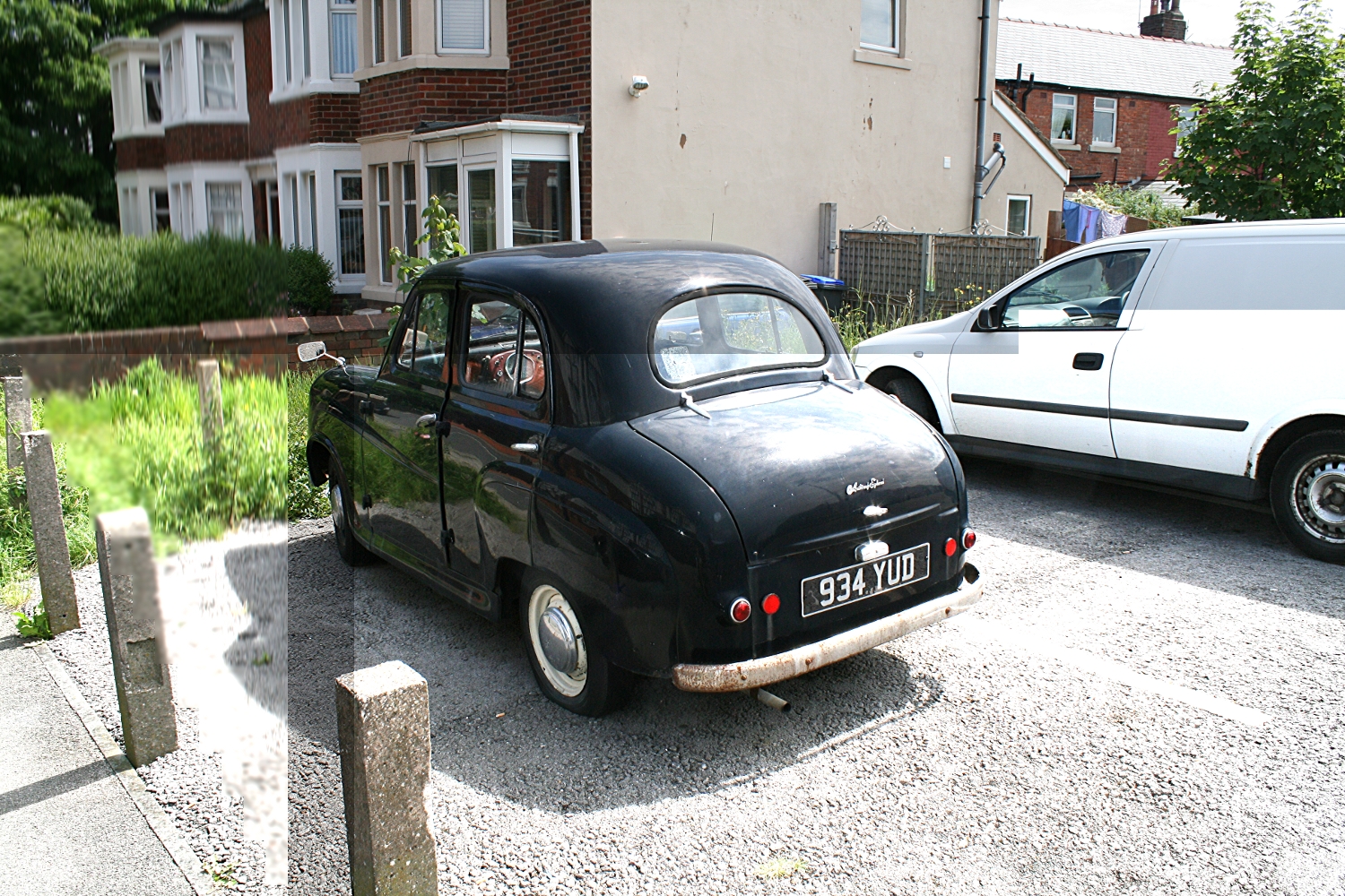
Rescue me! - Last road taxed until the end of 2011 this Austin A30 or perhaps A35 is parked up on private land in Blackpool. It has been there for some time and although it looks like someone's project, no work has been done to it in at least 3 months. It appears to have most of its glass and its tyres are still inflated. The inside is a bit of a mess but possibly not as bad as it seems. Hopefully some real enthusiast will take notice and whisk it away to be restored. There is a description and history of this vehicle here.


Front View of bonnet

From the road

Looks like the horn button has disappeared but moost of the seats are there

From the rear. Does not appear to have much rust

From the rear again

View through the side window.
For anyone who is interested it was there on Haweside lane between Spen Corner and Daggers Hall lane on the day this was published. I don't have any more info - but I know it must belong to someone!

Sunday, 3 June 2012

Catterall Cross - Daniel Fold Cross

This cross is situated at the side of the A6 at Catterall. The location is shown here. In the book "The Ancient Crosses and Wells of Lancashire", the name Daniel Fold Cross is used. It also says that the cross has been moved to its present position. I do not have information as to its previous position. Henry Taylor first described it in 1906.
View looking "down" A6 towards Preston. Just come out of the Churchtown turn off.
The cross is almost exactly centre of picture.

View from across the road.
There is a geocache somewhere near here

Looking south . The plaque on the cross can be clearly seen

Looking  north. This is the same or similar
picture to the one in the book

RE-ERECTED BY
CATTERALL
PARISH COUNCIL
IN 1984 TO COMMEMORATE
HERITAGE YEAR

Close up of the base

Another close-up of the base
Wyre Borough Council considers this to be a resting place for travellers carrying coffins on the way to St Helen's church at Kirkland. St Helen's church was the Parish Church in Garstang. There does not seem to be much sense in this, as Garstang is at least a mile up the road. 

Friday, 25 May 2012

Churchtown, Garstang

I have not done St Helen's church or the Crosses justice. Unless you use flickr, there does not appear to be a photo of the cross. The two crosses that are mentioned in the Wikipedia Article do not refer to what seems to be a market cross or a preachers cross. 

The booklet "The Ancient Crosses and Wells of Lancashire" tells me that this cross was erected by Alexander Butler of Kirkland Hall in the early part of the nineteenth century re-using the earlier base steps and square shaft. The Butlers were the predominant family in the area. Another visit is definitely required. 

There seems to be no extra information about the cross either.

It seems there are actually the fragments then of at least 3 crosses in close proximity. This does not include Hagg Wood Cross either.


Churchtown Market Cross

There is a clear difference between the apparent  antiquity of the steps and square base
compared to the round shaft.

View from the cross towards St Helen's Church

From the cross towards the Horns pub and thence to Garstang


Perhaps I need to return in 200 years


Churchtown Churchyard Cross. This cross was restored in 1930 by the gift of Jane Moncrieff
It used the ancient base of the cross at the south side of the church.


View towards the Market Cross from the church entrance
This page is very much a work in progress and will be updated as soon as I can return. I feel that there is more to be found. As the church is dated from the 13th Century and is a Grade 1 building it really does demand a revisit.

Friday, 18 May 2012

Jubilee Fountain at Buckley Wells, Bury


These photos were taken at the end of the "Peelers" hike in March 2012. I knew the fountain existed but at the time I was more interested in the other monuments close by. I passed this fountain on the way to school for five years. Always seemed out of place then. It still seems so. This drinking fountain is placed at the join of Manchester New Road and Manchester Old Road to commemorate the Diamond Jubilee of Queen Victoria in 1897. It seemed the fountain was boarded up until the summer of 1899. A railway tunnel was constructed underneath. The architect was Thomas Rodgers Kitsell. The Fountain is built of Portland stone and also Granite. There is plenty of weathering at the top of the fountain as well as vandalism over the years too. There were apparently gargoyles of lions heads that filled the lower troughs, there was also a bronze statue of a small boy on top of the granite stand. This has now gone and replaced by a basket for flowers.


The weather vain is still intact,
although a close inspection reveals very extensive wear on the Portland stone.
The ornaments that stick out actually carry the water from the roof away from the body of the fountain.
This face has the head of a man on it. The other a horse.

The inscription around the cornice reads :
THE FOUNTAIN OF LIVING WATERS
 IF ANY MAN THIRST
LET HIM COME UNTO ME AND DRINK
VIC. REG. 1897 60 YEARS
This is looking down towards Manchester from the Clock Tower

The drinking troughs can be seen. Left is Manchester and right is Bury Town Centre
To the right is a tiny grassed area which is related to the monument

The centre of the monument under the canopy.
A  bronze statue once stood on top of the turned granite column

Primulas. There is some bronze work behind the flowers. Quality casting too.

Close up of the base, Quite a lot of wear.
One of the round base stones is missing too. I never spotted that!

Close up of the opposite side. The other side has the man's head
The ears have completely disappeared with the weather

Small park in the background.
The fountain was donated by a Miss Eliza Anne Openshaw,
 which was made anonymously by a local vet ,
William Noar who actually was the brother in law of the architect.
The Openshaws were a well known local family.
Eliza Anne Openshaw was born about 1831. She was the daughter of Oliver Ormerod Openshaw and Dorothy Greenhow. The censuses showed she lived in Bury all her life. The 1871 census names 64 Tenterdon street as her address which will have been approximately 600 yards or so from the fountain.

She died at the age of 76 in March 1907. It seems she had five brothers whom she outlived. There is also an Openshaw Park at Pimhole in Bury. I suspect thast this is also connected with same family. Thomas Horrocks Openshaw attained a degree of notoriety when he was connected with the "Jack the Ripper" case.

Monday, 14 May 2012

Stainton , near Kendal

On the road to Natland near Kendal, spotted these two objects. Parked up and photographed them. They are literally 50 yards apart. They are a wooden cross made in/carved in 1999 to mark the Millenium and a milestone, probably iron, painted and well preserved. It was one of the first  warm days in spring. 
View from the road

FIVE
WATER MILLS
ONCE EXISTED
BESIDE
ST. SUNDAY'S
BECK
HALFPENNY
MILL BRIDGE
SKETTLEGILL
STAINTON
AND
STAINTON CROSS

The reverse of the cross

Stainton milepost

Burton 7 miles
1826
Kendal 4 Miles
The rust showing through on the casting. The inscription reads:
T. Winder
Gatebeck Foundry

T Winder was responsible for many of the mileposts around the Cumbria area


Another view

Facing the wooden cross from the milemarker.

Closer still! Millie the van posing!

This village sign. carved by
John Marshall of Stainton
from a local oak tree felled in
 a storm, was erected on
15.12.1999 to commemorate
 the new Millenium

THE
VILLAGE
BELONGED
TO
GILLEMICHAEL
IN 1066
AND THE
CHAPEL
ENDOWED
BY ANSELM
DE FURNESS
CIRCA 1157

Distant view from Millie, the cross in the foreground
and the milemarker to the right of the tree.

Natland was interesting too!