Milestones, Boundary Markers, Historical Artifacts, Street Furniture, lost roads and buildings.

There are many traces of our ancestors scattered around our landscape. Mile Markers and Boundary stones are there too. The Milestone Society believes that there are approximately 9000 left in the United Kingdom. Some are cherished but others are hidden in hedgerows, some have been unwittingly destroyed by crashes, road equipment or even stolen. Roads have been straightened to make them safer. There are old gateposts still left in place, old buildings, and place names that declare an evocative past. The aim is to capture some of this information at least photographically before it disappears.

Although the Fylde Coast does not have ancient history, the Romans apparently struggled to Kirkham. There have been huge changes in the last two centuries from literally a a few fishermans' and agricultural dwellings, to a full blown tourist and light engineering industry.

More historical information can be found here about the Fylde coast.

It also seems that time has marched on and left what appears to be some very respectable buildings... which just should be used, but seem to have no worth.

Links from this Blog

Nearly-Midnight The genealogy website relating to the family. A tangled web of people all related to one another, explore!
Memorials Website dedicated to War Memorials - The majority in the North of England. Visits to churches, but also memorials in out of the way places.
Robert Clark The Father of Henry Martyn-Clark - A missionary out in the North-West Frontier of India. One of the first Europeans to set foot in Afganistan
Affetside Census
A small village north of Bury, Lancashire, I can trace many of my immediate ancesters from there. On the Roman Road, Watling Street
Andrew Martyn-Clark My Father and his part in my World. Also my mother and his parents too.
Henry Martyn-Clark My Great Grandfather, his roots and his achievements. Discusses malaria but also his confrontations with Islam.

Sunday, 5 June 2011

Gisburn Horse and Cattle trough

Looking down  the Nelson Road.
Gisburn is positioned on the A59 that runs past British Aerospace. the first thing you meet on the left are sheds for the cattle market.  The trough has running water, whether it is supplied from a well or standing water. However considering the size of the trough, it cannot really have watered many cattle.

Closer view of the Cattle Trough
Looking up the Nelson Road

 Queen's Silver Jubilee
 My mission was to photograph and log the War Memorial at Gisburn. I parked up and spotted the watering trough at the Nelson junction 100 yards from the memorial on the A682 to Nelson.  The rock pictured commemorates the Queen's Silver Jubilee. It is placed very close to the memorial. This information will be placed on a different page.
However there is a link to the Gisburn Village website here. Lots of family history and old photo's too


Sunday, 8 May 2011

Blackpool Horse Troughs

Love them or hate them, Blackpool still has horse driven Landaus. There are two horse troughs on the promenade and they are used by the landau owners.

Chapel Street facing South
They date back to the 1890's and early 20th. century. Having worked in Blackpool for many years, I am convinced that they have moved around over the years. The first trough is at the junction of Chapel Street and the Promenade. This is directly opposite Central pier. Although the landaus do go all the way up the prom, it's rare they travel past Gynn Square.

This horse trough has the following inscription "BE MERCIFUL TO ALL GOD'S CREATURES"

"THE GIFT OF MRS BRAYBROOKE 1809" and "CATTLE TROUGH ASSOCIATION, VICTORIA STREET, SW"
Research shows that Mrs Braybrooke was an anti-vivisectionist. There is more information here.
Simpson Street looking south
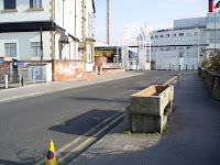
The second horse trough in Blackpool is at the southern end of the promenade, almost opposite the Sandcastle but set one road back on Simpson Street. I am almost sure this Horse trough has been moved in the past. This is approximately 2 miles from the other. Again the landaus do not tend to go much further than the pleasure beach. It is also opposite the new Travel Lodge hotel, which is on the site of the Balmoral hotel. This trough is older than the other. The inscription reads "BE KIND AND MERCIFUL TO ALL GOD'S CREATURES"     "METROPOLITAN DRINKING FOUNTAIN AND CATTLE TROUGH ASSOCIATION"   "THE GIFT OF A. LLOYD 1893" (I believe this to be the date. I can not find any references to A Lloyd anywhere. This is the location of the trough.

Both Troughs appear to be of granite, there is a catchment area underneath which also has water in in. Both horse troughs are in working order and are well used during the summer by horses. They are a sense of endless amusement to holidaymakers who do all sorts of unspeakable things to them too.
There is a link to the Water Fountain Association here. There is also an extended collection of photos of the Blackpool troughs here. Its hard to think that both these troughs have been in Blackpool for over 100 years.
Thursday, 5 May 2011

Kirkby Lonsdale six miles away


This milestone is set 6 miles from Kirkby Lonsdale and 6 mile from Kendal. Like the others it is painted white and the letters are picked out in black. The Grid Reference is 572868. The reference from the milestone society is WE_KLKDa06  The location of the milestone can be found here

Kirkby Lonsdale seven miles away


 This milepost is situated seven miles from Kirkby Lonsdale. It has been kept in quite good condition. The stone is painted white and the lettering is picked out in black paint. The map reference is 566883. The stone is on the B6254 and is 100yards esat of Hutton Yeat. The reference for the milestone on the milestone database is WE_KLKDa07. The location of the milepost is here


Wednesday, 4 May 2011

Kirkby Lonsdale eight miles away


This mile post is set a few hundred yards west of Middleshaw on the B6254 Its map reference is 554892
The reference number for the milestone society is WE_KLKDa08. The milestone is situated northern side of the road. Originally painted white with black lettering, but the paint is peeling and although the stone is in good condition it appears a bit tatty.
The location of the milepost can be found here


Tuesday, 3 May 2011

Kirkby Lonsdale four miles away


Looking North
  
Looking South

This milepost is situated on the B6254. It seems this road was called the "Old Scotch Road" The milepost is situated 4 miles from Kirkby Lonsdale and 8 miles from Kendal. It has been painted white recently but the paint is flaking off. The letters were highlighted in black. When the grass is long - it will be practically invisible. The map reference is SD 586 842 and is listed WE_KLKDa04 on the Milestone register. The location is here.

Sunday, 1 May 2011

Upper Rawcliffe - St Michaels-on-Wyre


I visited a car-boot sale near St Michaels. I knew the church was really old and that it had a memorial. I did not really believe how much history the church has, but seeing this milepost on the way in was a real bonus. The milepost is situated about 600 yards from the roundabout just before the church and the bridge over the river Wyre. Painted white and the lettering is picked out in black paint. The upper inscription says "Upper Rawcliffe" The Lancaster side reads - Garstang 4.25 miles and Lancaster 15 miles - The Blackpool side reads - Great Eccleston 2.25 miles, Poulton-le-Fylde 8.25 - Blackpool 12 miles.

The OS reference is SD 45784 4096. The road is called Blackpool road - A586

This has been surveyed by the Milestone Society and has the reference LA_BPGS12

Friday, 29 April 2011

Kirkby Lonsdale 1 mile away


Just outside Kearstwick
Facing Kendal

This mile post says Kirby Lonsdale is a mile away!
Facing Kirby Lonsdale
The map reference is 605802 and the road is B6254. The milestone is positioned just before Kearstwick as you travel into Kirkby Lonsdale.
Its location is shown here