Milestones, Boundary Markers, Historical Artifacts, Street Furniture, lost roads and buildings.

There are many traces of our ancestors scattered around our landscape. Mile Markers and Boundary stones are there too. The Milestone Society believes that there are approximately 9000 left in the United Kingdom. Some are cherished but others are hidden in hedgerows, some have been unwittingly destroyed by crashes, road equipment or even stolen. Roads have been straightened to make them safer. There are old gateposts still left in place, old buildings, and place names that declare an evocative past. The aim is to capture some of this information at least photographically before it disappears.

Although the Fylde Coast does not have ancient history, the Romans apparently struggled to Kirkham. There have been huge changes in the last two centuries from literally a a few fishermans' and agricultural dwellings, to a full blown tourist and light engineering industry.

More historical information can be found here about the Fylde coast.

It also seems that time has marched on and left what appears to be some very respectable buildings... which just should be used, but seem to have no worth.

Links from this Blog

Nearly-Midnight The genealogy website relating to the family. A tangled web of people all related to one another, explore!
Memorials Website dedicated to War Memorials - The majority in the North of England. Visits to churches, but also memorials in out of the way places.
Robert Clark The Father of Henry Martyn-Clark - A missionary out in the North-West Frontier of India. One of the first Europeans to set foot in Afganistan
Affetside Census
A small village north of Bury, Lancashire, I can trace many of my immediate ancesters from there. On the Roman Road, Watling Street
Andrew Martyn-Clark My Father and his part in my World. Also my mother and his parents too.
Henry Martyn-Clark My Great Grandfather, his roots and his achievements. Discusses malaria but also his confrontations with Islam.

Saturday, 8 December 2012

Dowbridge Cross at Kirkham

This excerpt comes from here: www.lancashire.gov.uk/.../KirkhamComplete_LowRes.pdf 

 Dowbridge was known as Galebridge in the medieval period, and was one of four bridges taking roads into Kirkham. It is first mentioned around 1268 in a charter for Cockersands Abbey as Dalebrigehevet (Farrer 1898). It is called Dale Brigge in a lease for c1279 (LSMR 1374). The bridge is likely to have always been wooden, as it was still recorded as made of wood up to the mid-nineteenth century (OS 1847 1:10,560). There was also a cross in Dowbridge documented in 1558. It marked the end of the Abbey lands on the east side of Kirkham. The site is still marked by a modern Latin cross of stone 1.55 metres high (LSMR 1375). Tarnbrick Cross (LSMR 1636), mentioned in the same agreement, stood near Tarnbrick Farmhouse and marked the western end of Abbey Lands, and the Headless Cross marked the southern boundary (LSMR 1376).
These latter two crosses lay outside the defined urban area for Kirkham.

Barely visible, Half buried

Clearly a chip out of the top section.
It is more obvious when you view it close to

No surprise that I have driven past this cross several times,
it was summer last time when the grass was higher.
I even had the map reference!


All that's left are further comments: the cross seems to be completely ignored, whether there is a pedestal in there beneath the "new" Latin cross is difficult to know. The fact that some fairly new damage has been done does not bode well for the future. I feel that this artifact(parts of) that may well date back 500 years is of concern. There are road signs and clear road works close to it. The definition held by English Heritage no longer matches the description of this cross.
This is monument no 586927 at English Heritage.

Tuesday, 27 November 2012

St Cedd's well - Lastingham

Well quite a lot of debate about the antiquity of this well - and indeed these Yorkshire wells. Looking at the architecture it does seem rather unlikely that any part of them dates back before 1800 at all (The guess is all mine). For me the significant thing is that there is a well at all and it does highlight the village of Lastingham. Unfortunately I did not realise there were 3 wells at Lastingham and I only found the one. However St Cedd is indeed a very real and significant person in the history of early Christianity.
A link to the datastore for the church is here. I features many items of interest which predate these wells.

The well on the road approaching Lastingham church
Close examination shows that it seems quite modern.
The spout is set in a lions mouth. The shape and form of the pillars is similar to the pillars in the crypt of Lastingham church


Made of wood
CEDD
ABBIE LASTINGA FUNDATOR
AD 654
OBIT AD 664 ET SEPTULTUS EST
?N ECCLESIA A DEXTRA ALTARIS

(Not sure this is even good Latin)
My translation is:
Founder of lastingham in AD 654, died in AD 664
The church will sustain (My interpretation)

Ecclesia - Church
Dextra from Dexter - right handed or the right to
Altaris from Alo Altum to nourish or sustain


Close up of the stone work above the wooden plinth
Quite primitive stone work

The church is is the distance. This is a bridge and the well is to the right.
The YNR plaque is right and the end of the left hand wall.
I have a feeling that this is to do with railways!
I could be wrong!
There will be a link to the Lastingham memorial and also to the church - fascinating places - got to be a second look.

Sunday, 25 November 2012

Ignioc Stone - St. Clement, Cornwall

Close to the entrance to the church at St Clement stands the Ignioc Stone, A detailed description of the scant information relating to this stone is here. Examination is persuasive that the top cross is considerably later. However the inscription is visible.

"VITALI FILI TORRICI" Vitalus son of Torricus

Thomas/1994, 244, caption to 15.7: `Note angle-bar A...and use of Demetian-originating horizontal I'.
Thomas/1994, 245, notes that this is the only Dumnonian inscription that uses an angle-bar A in a Latin-name.(from the above website)

(I have used Wiki links to supplement the information above- The pictures are all mine of course)

There are some comments about the validity of the Latin in the above website. The stone is dated approx 500 AD. The Romans had left Britain then. There influence was huge - but it seems that the inscription had been largely Celtic.

The Ignioc Stone
First scheduled as a National Monument
22nd March 1932 when it stood in the
vicarage drive from which it was
moved and re-erected here 8
November 1938. Rescheduled January 1939

The stone near the church

Just visible, the colour of the stone matches the church.

This path leads to beach. The whole aspect slopes down to the sea.
The grounds are unkempt - but it seems right and proper.
There will be a blog page dedicated to the church, the inside is extremely interesting and steeped in history. This is one place that must be visited to feel the antiquity and history.

Saturday, 17 November 2012

Cross Base at the church of St Thomas, Garstang

There are 2 interesting objects next to each other.
The first object is a cross base situated within the grounds of St Thomas'  church in Church street , Garstang.

Little to say about this except that the 2 parts actually do look like they belong together. The base has also had the corners chamfered as well as the shaft.

The cross base. The wall at the back is the edge of church property


This benchmark with a bolt is on the church, it is literally a few yards away. This is the entry on the bench mark register. 

1GL Bolt: Garstang, Church   

Bolt in North-west face of Garstang Church tower ; 4.99 ft. above ground [1GL, Liverpool to Port Carlisle, Mark No. 157]; PA BOLT W ANG ST THOMASS CH TWR (22.8256m ODN, 0.5m AGL).

Location
Grid reference: SD 4907 4505.
Landranger 102: Preston & Blackpool, Lytham St Anne's.
Structure: Church / Chapel.
Waypoint: BT1321.

Neighbouring Bench Marks
BM Garstang Bridge (NBM) 224.72m to the east.
BOLT Garstang Bridge 241.66m to the southeast.
BOLT Highroad Bridge 722.50m to the southeast.
PIVOT Garstang, Milestone, Preston 10 1.04km to the southeast.
BOLT Calder Bridge 1.95km to the southeast.
The nearest fundamental bench mark is Lancaster, 16.13km to the north.

First Primary Levelling, England & Wales (1840-60)
This bench mark was used during the First primary levelling, England & Wales, and was levelled with a height of 75.0420 feet [22.8728 metres] above mean sea level (Liverpool datum). It was included on the Liverpool to Port Carlisle levelling line. The surveyor's description was No. 157. Bolt in North-west face of Garstang Church tower ; 4.99 ft. above ground (p415).

Third Geodetic Levelling, England & Wales (1950-68)
This bench mark was used during the Third geodetic levelling, England & Wales.

Logged Visits
Visited on 16th September 2012 by dal. Condition: Good.
Bolt at centre of cut mark. Fine condition. The two sides of the arrow have double cuts.
 I suspect dal had visited it at the same time as me.
The Garstang church benchmark - I do not really look out for these things.
I also discovered 2 servicemen's graves in the churchyard.

All Hallows church sundial, Bispham

Seven metres south of the parish church in Bispham there is a square stone pillar placed in what appears to be an octagonal stone base. The stone base is "tied" with straps to hold it together.

This object has several pictures on the internet. However seeing it for real, one senses the antiquity. These are my 2 pictures.

Taken towards the Lych Gate,
facing Bispham village, a general south direction.

From the south door
This is the excerpt from English Heritage.

SD 34 SW BLACKPOOL ALL HALLOWS ROAD, BISPHAM

1/2 Sundial 7 metres South of
Bispham Parish Church (All Hallows)

II

Sundial on stone shaft said to be base of former cross. Shaft of square
section approximately 1 metre high, mounted in octagonal stone block on
circular stone disc; incised letters "IH" on north side, "RB" on west side
("IH" = "John Hull", donor of sundial, "RB" possibly "Robert Broadbelt",
parish clerk 1678-1715). Sundial plate originally dated 1704 with names
John Hull and Joh Hebblethwaite, and motto "Die dies Truditur", now only
partially legible. (VCH Lancs vol. 7 p. 244).


Listing NGR: SD3189840566

The Latin inscription, which is open to interpretation,  means " day rushes after day"

There are 2 more objects in the church which are very interesting as well as the memorials which have not yet been described.

I have not brought anything new to this object. Although it is one of a surprising number of older objects still about the Fylde Coast.

Thursday, 18 October 2012

Kirkham Headless Cross

If you turn left at the centre of Kirkham and head south along Freckleton road you will reach the A583 Kirkham bypass, the main road between Preston and Blackpool. Cross straight over, still on Freckleton road, you will meet a right angle bend. Hidden behind the road warning sign is the Headless Cross. Only its a modern Latin Cross. It is set on the site of the old cross. This is the link to the cross at the Eastern limit; The Dowbridge cross.
From the inside of the bend

The road to the left goes to Kirkham

Close up Shows the Latin Cross clearly
Seemingly this cross marked the southernmost boundary of Cockersands abbey.
There is a wikipedia reference to the abbey here. I do not know the date of the erection of the Latin Cross.

Tuesday, 10 July 2012

The Stranded Rosaleen


In the same newspaper as the coroner's report into Jack Parkinson's death was little snippet.Of course not to diminish Jack in any way, but to point out that he was a member of the crew that tried to refloat the Rosaleen.

An unsuccessful attempt was made to refloat the SS “Rosaleen” at Fairhaven on Wednesday morning. The steamer which was stranded on the 6th Inst (January 1911), had been raised from the beach and shipways laid down. It was arranged to launch her when the tide permitted. On Wednesday the tide was at its height at 10:54 and a large crowd of persons was present to witness the launch, not withstanding the fact that the rain was streaming in torrents. Two powerful tugs were requisitioned and were attached to the stranded steamer by by means of a strong wire hawser. Anchors were also attached to the vessel, and the engine was set going. When the props that were holding the steamer up were removed, however the vessel dropped down a little and some of the shipways were misplaced. The tugs tried in vain to move the “Rosaleen” and the effort to relaunch her had to be abandoned for the present.
Published on Saturday December 23rd 1911
 
The SS Rosaleen was renamed the SS Kyle Prince and she ran aground and lost  in 8/10/1935

I am trying to find out more info about the Rosaleen but there does not seem to be any "out there" Still chipping away.

In the fortunate position of finding a picture of the SS Rosaleen.


Sunday, 17 June 2012

Queensway building land


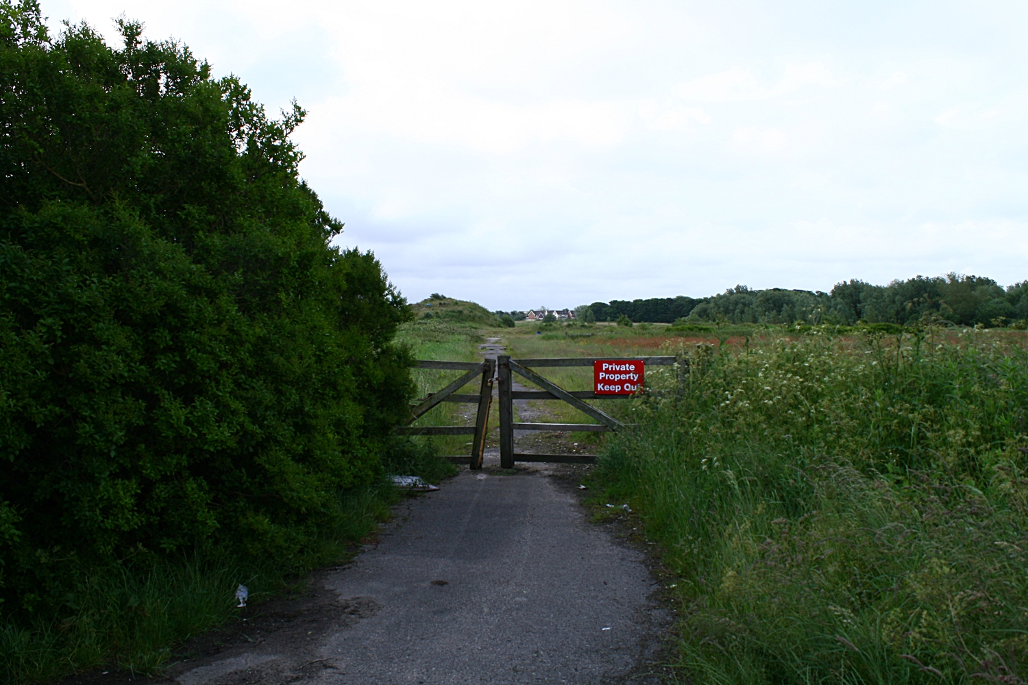
This is the road that comes straight off the Queensway junction. This lane (before here) hooks to the left and goes to Easterleigh. This lane used to go to a disused barn next to a disused bungalow where a murder took place. (Another link)The house was bulldozed and the pile of rocks and dirt is effectively the remains of a murder scene. This is the place I took the panorama. I  think the land may be owned by a local builder (Kensington). The houses in the distance are the edge of Cypress point.
Looking back towards Queensway The road lights are the lights that are on Queensway.
This was taken  at the bottom of the mound.

This is a 360 from besides the bush at the top of the mound in the previous photo. Easterliegh Animal sanctuary is on the left side of the bush. The junction at Kilnhouse lane is on the very far right of the panoramic. This looks good on a three screen rig.
Felt I needed to photograph the land at the junction of Kilnhouse lane and Queensway in St Annes. There have been numerous applications for building. The wildlife is endangered. Traffic will be appalling, services will be strangled. Another bit of the landscape gone for ever. Cypress Point has awfull water table issues. Pumps are running 24/7 just to stop the houses flooding. There is a considerable amount of instability here. The actual land is only a couple of feet above the highwater mark. However it gave me a chance to get up early with the tripod and try using the shots to build a panoramic of this land that will now be turned over to housing.

The second panorama of the day is taken from the inner side of Queensway. There is a triangle of heavily overgrown land next to the industrial estate which has got planning permission.

The path that extend through the picture goes across the fields and joins Queensway at the far end. The airport is facing us. The industrial estate is right in the centre. The path to the left is the reverse of the path that heads towards the tree and heads towards Queensway. If you carry on you cross Queensway and meet the road immediately above.

The panoramas were rendered in Hugin on a Linx Mint rig.

This is an extract from the Blackpool Evening Gazette on Friday 22nd of June 2012

A CONTROVERSIAL new housing development on the outskirts of St Annes has been given the go-ahead.

Kensington Developments has fought for years to win planning permission to build 1,150 homes on land off Queensway - and today a Government planning inspector and the secretary of state have finally given them the green-light.
The plans have been the subject of two planning inquiries after Fylde Council rejected the proposal - and dozens of local residents came out in fierce opposition to the scheme.
Plans for the M55 link road, which will connect Lytham and St Annes with the motorway, are closely tied to the development and today’s decision means that project will also go ahead.


Mixed views over major homes plan  

Published on Wednesday 12 December 2007 15:11

RESIDENTS have had their first look at plans for a multi-million pound housing estate set to transform rural land near St Annes.
The scheme, revealed in Tuesday's Gazette, would see Kensington Developments transform land off Queensway by building 1,150 homes over a 10-year period.
The proposed site, on the border of St Annes and Blackpool, will see environmentally friendly homes built at a rate of 175 a year, a primary school, an 86-acre park and a 50-acre deer park. The development will include 259 affordable homes.
Kensington will spend 20m completing the long-awaited M55 Heyhouses link road, constructing a Heyhouses Lane bypass and building a new roundabout at the junction of Queensway and Kilnhouse Lane.
Robin Howe, 61, who lives on Heyhouses Lane, believes the scheme is a "golden chance".
He said: "I think it is a fantastic opportunity for us to move forward.
"One of the massive benefits will be to turn Heyhouses Lane back into a road instead of a motorway."
Mr Howe's wife Debbie, 46, believes more properties are desperately needed.
She said: "People are screaming out for them because they have nowhere to live.
"Something like this will take the town on because it is stagnating now."
However, other residents fear the development will add to already hectic traffic in the Fylde town.
Palmira Stafford, 46, who lives in St Annes Road East, said: "I am concerned there is so much housing in such a small space.
"I have worries about the access roads coming into the borough. Our road is really busy at certain times anyway."
Derek Unsworth, 74, of Eldon Court, doesn't believe a major housing development should be built so close to Blackpool Airport.
He said: "I am dead against it. They will be sending jumbo jets down there soon and I believe it would be a big mistake to build anything other than industrial units there."
Peter Liversidge, deputy managing director of Kensington, was on hand to talk to people about the plans.
He said: "We are very pleased with the public's reaction and interest in the scheme.
"Most people say the link road is a much-needed facility in the area. A residential development is the only way to do that.
"People have been particularly worried about the impact on wildlife but we will have a park alongside a wetland habitat."

A 50 Acre Deer Park - What!!

Make your own minds up.