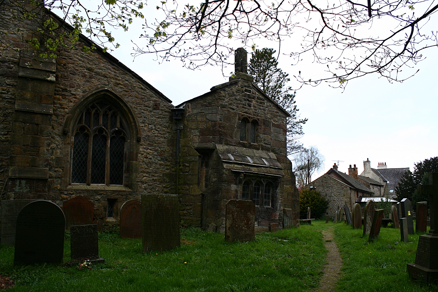
Milestones, Boundary Markers, Historical Artifacts, Street Furniture, lost roads and buildings.

There are many traces of our ancestors scattered around our landscape. Mile Markers and Boundary stones are there too. The Milestone Society believes that there are approximately 9000 left in the United Kingdom. Some are cherished but others are hidden in hedgerows, some have been unwittingly destroyed by crashes, road equipment or even stolen. Roads have been straightened to make them safer. There are old gateposts still left in place, old buildings, and place names that declare an evocative past. The aim is to capture some of this information at least photographically before it disappears.

Although the Fylde Coast does not have ancient history, the Romans apparently struggled to Kirkham. There have been huge changes in the last two centuries from literally a a few fishermans' and agricultural dwellings, to a full blown tourist and light engineering industry.

More historical information can be found here about the Fylde coast.

It also seems that time has marched on and left what appears to be some very respectable buildings... which just should be used, but seem to have no worth.

Links from this Blog

Nearly-Midnight The genealogy website relating to the family. A tangled web of people all related to one another, explore!
Memorials Website dedicated to War Memorials - The majority in the North of England. Visits to churches, but also memorials in out of the way places.
Robert Clark The Father of Henry Martyn-Clark - A missionary out in the North-West Frontier of India. One of the first Europeans to set foot in Afganistan
Affetside Census
A small village north of Bury, Lancashire, I can trace many of my immediate ancesters from there. On the Roman Road, Watling Street
Andrew Martyn-Clark My Father and his part in my World. Also my mother and his parents too.
Henry Martyn-Clark My Great Grandfather, his roots and his achievements. Discusses malaria but also his confrontations with Islam.

Sunday, 3 June 2012

Catterall Cross - Daniel Fold Cross

This cross is situated at the side of the A6 at Catterall. The location is shown here. In the book "The Ancient Crosses and Wells of Lancashire", the name Daniel Fold Cross is used. It also says that the cross has been moved to its present position. I do not have information as to its previous position. Henry Taylor first described it in 1906.
View looking "down" A6 towards Preston. Just come out of the Churchtown turn off.
The cross is almost exactly centre of picture.

View from across the road.
There is a geocache somewhere near here

Looking south . The plaque on the cross can be clearly seen

Looking  north. This is the same or similar
picture to the one in the book

RE-ERECTED BY
CATTERALL
PARISH COUNCIL
IN 1984 TO COMMEMORATE
HERITAGE YEAR

Close up of the base

Another close-up of the base
Wyre Borough Council considers this to be a resting place for travellers carrying coffins on the way to St Helen's church at Kirkland. St Helen's church was the Parish Church in Garstang. There does not seem to be much sense in this, as Garstang is at least a mile up the road. 

Friday, 25 May 2012

Churchtown, Garstang

I have not done St Helen's church or the Crosses justice. Unless you use flickr, there does not appear to be a photo of the cross. The two crosses that are mentioned in the Wikipedia Article do not refer to what seems to be a market cross or a preachers cross. 

The booklet "The Ancient Crosses and Wells of Lancashire" tells me that this cross was erected by Alexander Butler of Kirkland Hall in the early part of the nineteenth century re-using the earlier base steps and square shaft. The Butlers were the predominant family in the area. Another visit is definitely required. 

There seems to be no extra information about the cross either.

It seems there are actually the fragments then of at least 3 crosses in close proximity. This does not include Hagg Wood Cross either.


Churchtown Market Cross

There is a clear difference between the apparent  antiquity of the steps and square base
compared to the round shaft.

View from the cross towards St Helen's Church

From the cross towards the Horns pub and thence to Garstang


Perhaps I need to return in 200 years


Churchtown Churchyard Cross. This cross was restored in 1930 by the gift of Jane Moncrieff
It used the ancient base of the cross at the south side of the church.


View towards the Market Cross from the church entrance
This page is very much a work in progress and will be updated as soon as I can return. I feel that there is more to be found. As the church is dated from the 13th Century and is a Grade 1 building it really does demand a revisit.

Friday, 18 May 2012

Jubilee Fountain at Buckley Wells, Bury


These photos were taken at the end of the "Peelers" hike in March 2012. I knew the fountain existed but at the time I was more interested in the other monuments close by. I passed this fountain on the way to school for five years. Always seemed out of place then. It still seems so. This drinking fountain is placed at the join of Manchester New Road and Manchester Old Road to commemorate the Diamond Jubilee of Queen Victoria in 1897. It seemed the fountain was boarded up until the summer of 1899. A railway tunnel was constructed underneath. The architect was Thomas Rodgers Kitsell. The Fountain is built of Portland stone and also Granite. There is plenty of weathering at the top of the fountain as well as vandalism over the years too. There were apparently gargoyles of lions heads that filled the lower troughs, there was also a bronze statue of a small boy on top of the granite stand. This has now gone and replaced by a basket for flowers.


The weather vain is still intact,
although a close inspection reveals very extensive wear on the Portland stone.
The ornaments that stick out actually carry the water from the roof away from the body of the fountain.
This face has the head of a man on it. The other a horse.

The inscription around the cornice reads :
THE FOUNTAIN OF LIVING WATERS
 IF ANY MAN THIRST
LET HIM COME UNTO ME AND DRINK
VIC. REG. 1897 60 YEARS
This is looking down towards Manchester from the Clock Tower

The drinking troughs can be seen. Left is Manchester and right is Bury Town Centre
To the right is a tiny grassed area which is related to the monument

The centre of the monument under the canopy.
A  bronze statue once stood on top of the turned granite column

Primulas. There is some bronze work behind the flowers. Quality casting too.

Close up of the base, Quite a lot of wear.
One of the round base stones is missing too. I never spotted that!

Close up of the opposite side. The other side has the man's head
The ears have completely disappeared with the weather

Small park in the background.
The fountain was donated by a Miss Eliza Anne Openshaw,
 which was made anonymously by a local vet ,
William Noar who actually was the brother in law of the architect.
The Openshaws were a well known local family.
Eliza Anne Openshaw was born about 1831. She was the daughter of Oliver Ormerod Openshaw and Dorothy Greenhow. The censuses showed she lived in Bury all her life. The 1871 census names 64 Tenterdon street as her address which will have been approximately 600 yards or so from the fountain.

She died at the age of 76 in March 1907. It seems she had five brothers whom she outlived. There is also an Openshaw Park at Pimhole in Bury. I suspect thast this is also connected with same family. Thomas Horrocks Openshaw attained a degree of notoriety when he was connected with the "Jack the Ripper" case.

Monday, 14 May 2012

Stainton , near Kendal

On the road to Natland near Kendal, spotted these two objects. Parked up and photographed them. They are literally 50 yards apart. They are a wooden cross made in/carved in 1999 to mark the Millenium and a milestone, probably iron, painted and well preserved. It was one of the first  warm days in spring. 
View from the road

FIVE
WATER MILLS
ONCE EXISTED
BESIDE
ST. SUNDAY'S
BECK
HALFPENNY
MILL BRIDGE
SKETTLEGILL
STAINTON
AND
STAINTON CROSS

The reverse of the cross

Stainton milepost

Burton 7 miles
1826
Kendal 4 Miles
The rust showing through on the casting. The inscription reads:
T. Winder
Gatebeck Foundry

T Winder was responsible for many of the mileposts around the Cumbria area


Another view

Facing the wooden cross from the milemarker.

Closer still! Millie the van posing!

This village sign. carved by
John Marshall of Stainton
from a local oak tree felled in
 a storm, was erected on
15.12.1999 to commemorate
 the new Millenium

THE
VILLAGE
BELONGED
TO
GILLEMICHAEL
IN 1066
AND THE
CHAPEL
ENDOWED
BY ANSELM
DE FURNESS
CIRCA 1157

Distant view from Millie, the cross in the foreground
and the milemarker to the right of the tree.

Natland was interesting too!

Monday, 19 March 2012

St John's Well, Harrogate

Now a sewing shop, St John's well stands isolated on the A661 Wetherby Road. IT is in an area of parkland called the Stray. It is also very close to another memorial I photographed some time ago.
This particular well was named after a church, later replaced by Christ's Church in Church Square.
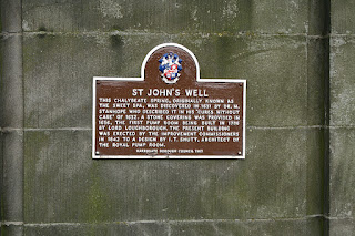

St John's Well plaque,
Inscription below

 THIS CHALYBEATE SPRING, WAS ORIGINALLY KNOWN AS THE SWEET SPA, WAS DISCOVERED BY DR. M.STANHOPE, WHO DESCRIBED IT IN HIS "CURES WITHOUT CARE" OF 1632. a STONE COVERING WAS PROVIDED IN 1656. THE FIRST PUMP ROOM BEING BUILT IN 1786 BY LORD LOUGHBOROUGH. THE PRESENT BUILDING WAS ERECTED BY THE IMPROVEMENT COMMISSIONERS IN 1842 TO A DESIGN BY I.T.SHUTT, ARCHITECT OF THE ROYAL PUMP ROOM.

For a description of chalybeate go here. I had never heard of this word 'til now!
Thre is a reseach document on spring water here.
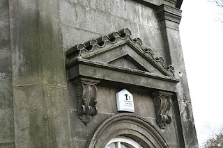


The arch over the front door, compete with burgular alarm!
View from the rear - The plaque is just visible

The other rear view. The building has 8 sides.

This is clearly a drinking trough. There is a waste pipe running towards the ground.
The vertical slot looks like it may have had a lever attached at some point.

The main Wetherby Road - Wethereby is to the right. The photo is from the Stray.

Below is an excerpt from the history of Christ Church a few hundred metres from St Johns Well. The link to the website is here.

The real story of the worshipping Christian community in Harrogate begins in 1749 when a Chapel of St John was built so that those who had come to take the waters of the developing spa town had a place in which to say their prayers. It was a small building capable of seating about 100 people and was a chapel-of-ease to the mother church of St John the Baptist at Knaresborough. This was the first Christian community established in Harrogate and - other than the chantry chapel - the first church building to be built in the town. This also demonstrates an often forgotten feature of the Church of England in the 18th century: it is a century often described as a time of little zeal in church life, but the Rector of Knaresborough, like many of his contemporaries, shows genuine missionary instincts in planting a new church in this growing partof his parish.

The new church building was known as St John's Chapel because of its links with its mother church at Knaresborough, but it was dedicated on 17 June 1749 as Christ Church. The links with Knaresborough remained until 1852 when Christ Church became a parish in its own right, and the patronage (i.e. the right of appointing the vicar) passed from the Rector of Knaresborough to the Bishop of Ripon. As Harrogate grew and prospered over the next 150 years four further parishes were formed from Christ Church, High Harrogate: St John's Bilton in 1858, St Peter's in the town centre in 1870, St Luke's in 1898, and St Andrew's Starbeck in 1911

Sunday, 11 March 2012

Austin 7 at Parlick!

Well Bowland is a magnificent place and Fell Foot is  is like a gateway to the fells. It is probably the least likely place you would ever dream of seeing an Austin 7!

Here are the pictures from a sunny Sunday in late February 2011. There are more pictures of Bowland and its locality at Gareth's blog here. Gareth if you read this I took several shots of the Gliders too! Visited several times over the last couple of years. This time I was in "Millie" the Romahome.

Here are the pictures of the Austin A7.

VVS106

Very little space here!

It's always a windy day at Fell Foot. That's why there are gliders!

From the rear

Closer up

Shot of the cabin, Try and ignore all the reflections

Who ever you belong to, thanks for letting us see you wonderful vehicle. Please use the photos if you wish but link back to lazylikesunday.net would be really appreciated. I have higher resolution photos too.