Milestones, Boundary Markers, Historical Artifacts, Street Furniture, lost roads and buildings.

There are many traces of our ancestors scattered around our landscape. Mile Markers and Boundary stones are there too. The Milestone Society believes that there are approximately 9000 left in the United Kingdom. Some are cherished but others are hidden in hedgerows, some have been unwittingly destroyed by crashes, road equipment or even stolen. Roads have been straightened to make them safer. There are old gateposts still left in place, old buildings, and place names that declare an evocative past. The aim is to capture some of this information at least photographically before it disappears.

Although the Fylde Coast does not have ancient history, the Romans apparently struggled to Kirkham. There have been huge changes in the last two centuries from literally a a few fishermans' and agricultural dwellings, to a full blown tourist and light engineering industry.

More historical information can be found here about the Fylde coast.

It also seems that time has marched on and left what appears to be some very respectable buildings... which just should be used, but seem to have no worth.

Links from this Blog

Nearly-Midnight The genealogy website relating to the family. A tangled web of people all related to one another, explore!
Memorials Website dedicated to War Memorials - The majority in the North of England. Visits to churches, but also memorials in out of the way places.
Robert Clark The Father of Henry Martyn-Clark - A missionary out in the North-West Frontier of India. One of the first Europeans to set foot in Afganistan
Affetside Census
A small village north of Bury, Lancashire, I can trace many of my immediate ancesters from there. On the Roman Road, Watling Street
Andrew Martyn-Clark My Father and his part in my World. Also my mother and his parents too.
Henry Martyn-Clark My Great Grandfather, his roots and his achievements. Discusses malaria but also his confrontations with Islam.

Sunday, 19 May 2013

Sir Nigel Gresley at Pickering Station

Sir Nigel Gresley needs no introduction. I visited Pickering in the summer of 2012 and visited the church, the castle and the station. The station with the historic feel of my childhood needs revisiting. What a magnificent engine - power and the majesty of the engine together with the ambience makes for something special. Here are the photos - but for once no substitute for the real thing.

On the platform of Pickering station

Sir Nigel Gresley coming in to the station pulling a special

Close up of the front of the engine

One of the original carriages

The British Rail Logo

This is seriously impressive, the heat was just emanating from this big wheel

Sir Nigel Gresley was the worlds fastest steam locomotive at one time
This was succeeded by Mallard

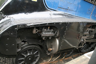
Close up of the valve gear

Close up of this majestic engine

Another close up


I like this shot! I don't know why?

ID Plate

This is really large, and hot, and smelly and wonderful!

Inside of cab complete with brew-cans for the driver and fireman

Close up of guages

Sir Nigel Gresley reversing back to the back of the train

Inside a carriage

Ready to be coupled to the coaches

Showing the lights

Right above the bogies

Reattaching the lights at the rear

Close up of the valve gear

Speedo!

To be attached to the rear of the train

Close up

The Brake! The last shot!


Waterloo Road bridge toilets

I recall when this building were Ladies and Gents toilets. However they have gone through a few changes over the years. Another comment on the internet believes they may have been a tramstop. Not sure trams ever went over any of the Blackpool bridges. I could just about buy into a bus shelter. They have been a variety of little shops over the years but they have never done well and ultimately gone down the plughole!

The road climbs to the crest of the hill then goes off to Spen corner.
To the right the road goes to the Royal Oak pub and then to the sea front.
South Shore station is just to the left.

I think these ornaments must have been added later,
they don't seem weather battered enough to be original


The concrete/stonework  is in a poor state of repair,
only a matter of time before they come down I suppose.
There are very few old public toilets left in Blackpool, most have been flattened, maintenance is a real issue.

Friday, 17 May 2013

A Bunker and Loopholed bridge at Devonshire road together with a biscuit factory!

There a quite a few WW2 artefacts relating to defence in Blackpool and the Fylde. Perhaps this is the least well known and least obvious. I have however managed to put this in a little more context than straight forward shots. The panorama and the shots with the cloudy skies were taken from the site of the now flattened abattoir. perhaps it's easy to see why no one would want to move into a house here. Don't mind doing any graveyard shots, but to be honest this is quite upsetting. Info underneath each photo:
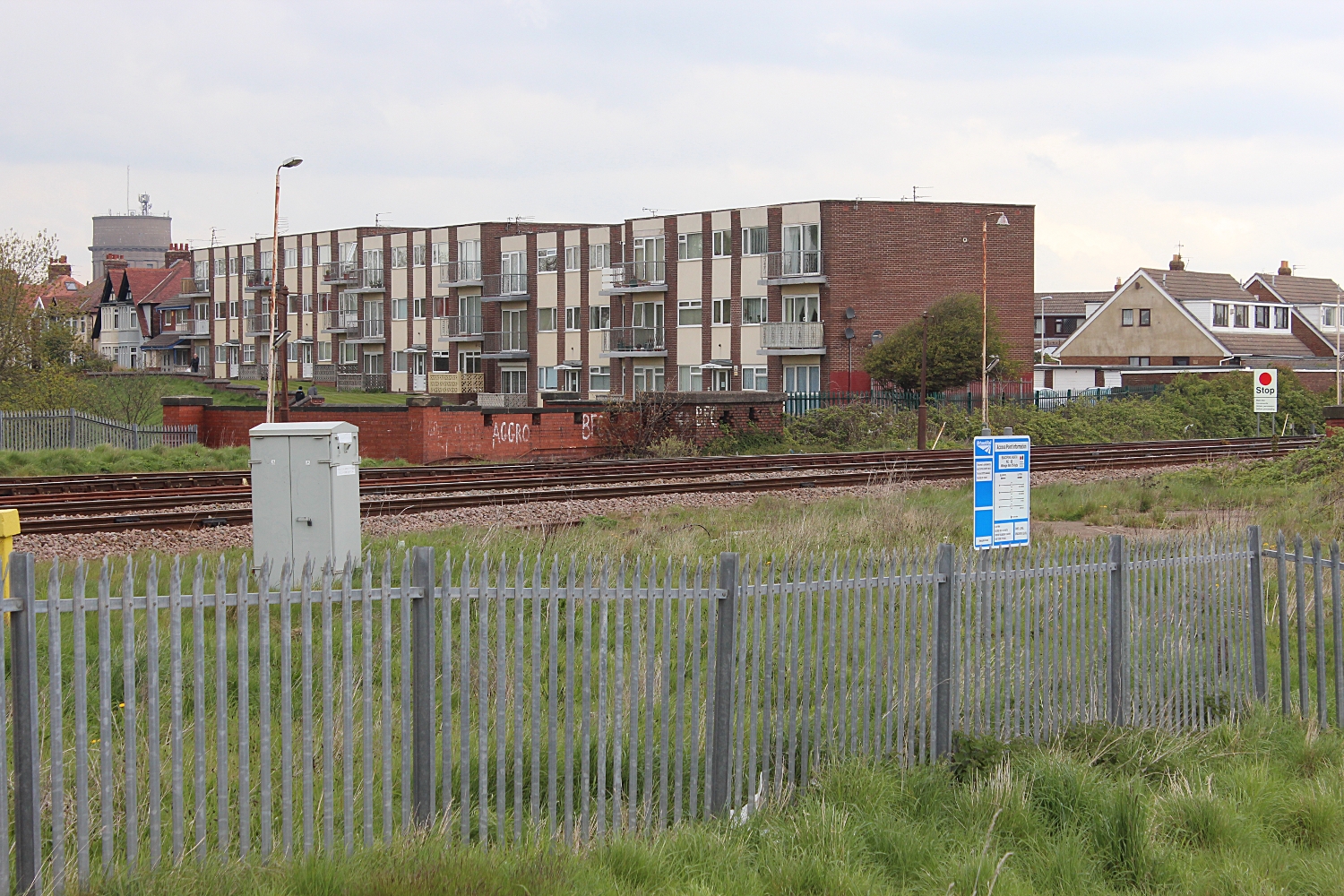
This is from the highest point of the rubble from the demolished abattoir. The railway line runs from Blackpool North station on the left to Layton, Preston and beyond. On the right just below the flats is the bunker which sits above the loopholed bridge. This faces north. Devonshire road is just in front of the flats too

This is the opposite view. The flats at Layton is the most obvious feature - due for demolition. I have many pictures of these from all over Blackpool. On the left is Burton's Biscuits. On the right is a new(ish) housing estate. Construction has stopped, perhaps someone will add a comment. Anyway the houses behind them are built on the remains of Billy Smith's Scrapyard and the Blackpool brewery. The houses to the right have started to be dismantled by the local hoodlums too. The road which runs from left to right is Devonshire road. Apologies for the strangely disjointed blue people carrier! I have got scarily big picture of both these panoramas.

Back to the bunker! This site has some more information and a little bit of history too as well as different photographs.

Looking North up Devonshire Road. This is the top of the bridge.
The loop holes can be seen on the left. The bunker is to the right.

Almost identical shot

This is too, but maybe a little clearer
This picture is practically looking straight at previous one.
I am just past the end wall of the flats above. This is the bridge looking south.

A little further on. Leaning over the fencing.
This is the roof of the bunker.
The road is below me

The same shot

Don't ask. Clearly not a telephoto!
Looking North. Devonshire road is beneath the bridge.
Layton Flats in the distance!

Added a bit of action - A train going to North Station!
The final section is showing the demolished area around the old abattoir - make your own mind up about this. Been like this for a few years now.

Close up of built houses,
tiles off and boarded up. The house to left are on Devonshire road
and the ones to the right are new lived in ones.


Further away, Layton flats about to be demolished.


Monday, 13 May 2013

Palm Beach Hotel

Situated on the seafront of Blackpool this slowly developing eyesore is earmarked for demolition by cash hungry developers!

Directly ripped from the Evening Gazette but found on a Bulletin board!

BOLD plans for an 11-storey hotel on Blackpool’s seafront have re-emerged.

The scheme to demolish the Palm Beach Hotel on New South Promenade in South Shore and replace it with a £14m new property is earmarked to have its planning permission renewed.

Since it was first approved in 2009, no work has been carried out on the development and the Palm Beach has been closed for around a year.

Blackpool Council’s planning committee is being recommended to renew the permission when its meets on Monday.

A report to the committee, chaired by Coun David Owen, says: “The introduction of relatively tall buildings in this location is to be welcomed in principle as it shows a level of investment and confidence in the area.”

However, some residents of nearby Arundel Court, St Martins Court and Clifton Drive have submitted fresh objections to the proposals.

They claim the buildings are too high, will be over-dominant and lead to a loss of privacy.

The Palm Beach scheme is one element of a comprehensive redevelopment plan for the whole of Bourne Crescent.

Outline planning permission was also granted in 2009 for hotels including The Colwyn, The Skye, The Trafford, The Sandpiper and The Headlands, which would see a mixture of residential and holiday accommodation built at each end of Bourne Crescent.

A third application for an 11-storey high residential development on the site of The Kimberley, The Waldorf and the Henderson hotels was refused because it did not include any holiday accommodation.

Hoteliers on Bourne Crescent say redevelopment is needed because of a decline in the number of guests choosing to stay in that part of Blackpool. 

 These are the Panoramas, there are some individual pix which will get uploaded. From a distance they look OK but from close up and from the rear they are ghastly

Head on from the prom. The Palm Beach complex is to the right
The actual building is a gentle curve away from the prom which is straight

The rear of the Palm Beach, the part that guests never see.
Can't believe that all this random plumbing for waste water is legal!
Grass growing !

The palm beach hotel - looks pretty elegant!
GET UP CLOSE!

 
The link above will find plenty of extra and interesting reading on this wonderfull town!

Monday, 6 May 2013

Samuel Ladyman drinking Fountain

Samuel Ladyman - Author: His observations of his Keswick life were entitled "
Thoughts and Recollections of Keswick and Its Inhabitants During Sixty Years (1885)" A facsimile is available from Amazon. This fountain is just below the Toll Cottage on the previous post.
Samuel Ladyman Drinking Fountain, Chestnut Hill

The Plaque reads:
"Drinking Water Fountain
One of Four Erected Circa 1875
Cleaned and Marked by
Keswick Civic Society 2003"
Born on 26 Dec 1812 to Thomas Ladyman and Mary Wharton. Samuel married Isabella Dixon and had 2 children. Samuel married Jane Routledge. Samuel married Mary Wharton. He passed away on 31 Jul 1885 in Crosthwaite, Cumbria, England. Here is a link to another. I wonder where the other 2 are. 


Toll Bar Cottage, Chestnut Hill, Keswick

Having got lost! again. Heading down the Castlerigg road seemed to be a good idea. I had to get to Keswick. Spotted this building. This is a really steep bit of hill. A good place to have a toll. I would suggest it is on what would have been the "main" road between Keswick/Penrith and the south. The next village of any significance will be Grasmere, then Ambleside. There is a little more info here. The toll roads are under researched and little known part of our heritage. The cottage is situated on a fork of the road. This site gives a little more information about  the cottage.

To the right of the cottage is the Penrith Road
The slope is fairly obvious

Looking from Keswick, up the Ambleside Road
The Samuel Ladyman Water Fountain is seen just to the left.
The road forks. The right fork heads off to Grasmere and the left to Penrith
 There was no competition for this Toll Road. There was no canal travel and the railways did not go this way.


Sunday, 5 May 2013

Pickering - Smiddy Hill

I walked into Pickering - this is the first part of Pickering that I really took an interest. There are some grand houses on the approach road too. I was to visit the wonderful church, the castle, and the railway too; but these will be another page.

John Wilson - Water Fountain

John Wilson Water Fountain
Cross behind and the church behind that

The inscription on the cross

The Cross with the Liberal Cub behind

The sensory garden, the cross - the John Wilson Fountain is just behind the cross.

Make no apologies for the panorama. IOt shows the Church, the cross and the water fountain.

I am pasting the 2009 Pickering Town council Newsletter below; Apologies about any copyright breeches - please copy and use the images if you wish. The panorama has already been published once.

Smiddy Hill
The Town Council is responsible for the two open spaces in the town centre,
Riverside Walk and Smiddy Hill. Some years ago, at Riverside Walk, the Town
Council created an amenity area from what had become an eroded bankside. The amenity with retaining wall, trees, small scale planting, seats and picnic tables is enjoyed by local people and visitors alike.

Smiddy Hill is also an area in the town centre where people can rest awhile. In the
centre of the open space is a cross which commemorates the reign of Edward VII
and the accession of George V. There is another memorial at the southern end to the late John Wilson. The deceased was a local councillor – he served on both Pickering Urban District Council and the County Council - and a member of the Labour Party. This memorial was erected in 1950. The only other structure is a raised sensory garden in front of the Liberal Club.

A small group of local people chaired by Councillor Margaret Lowe has been look-
ing at the open space at Smiddy Hill will known as the Lumley Rest Gardens. The group has come up with a series of recommendations which the Town Council is considering. The main recommendation is that the lower shrub bed and attendant railings are removed. This would open up Smiddy Hill from the south and show the
commemorative cross, backed by the buildings on the north side of Smiddy Hill, to better effect. The flower boxes at the base of the cross would be removed so that
the structure could be seen as a whole. The shrubbed area would be turfed and the seats which run along its top side moved to the eastern side of the open space. In addition the Wilson Memorial would be re-erected in the cemetery where the remains of John Wilson are buried. It has proved very difficult to make the memorial vandal proof: the tap has had to be replaced regularly and no longer can water run freely into the lower basin where it used to be available for dogs and birds. The lead inscription has suffered much wear and tear and hardly any of the lettering remains.

Grounds maintenance is undertaken by the Town Council with Pickering in Bloom and the Council is particularly grateful for the work that the In Bloom group has done with Pickering’s young people in creating floral displays in the open space. The Town Council hopes that this will continue and is also grateful to the In Bloom group for being willing to recreate the sensory garden.

The Town Council would not only appreciate any information you might have about the history of Smiddy Hill once it ceased to be a cattle market in the late nineteenth
century but also on the ideas for change.